


It has been close to seven years that I first wrote about the extension of the BIM concept of model-based design from the building domain to the infrastructure domain. At that time, Autodesk had recently launched InfraWorks as a “BIM-from-the-ground-up” infrastructure design application and was transitioning its flagship civil design application, Civil 3D, from being more CAD-like to BIM-like. Since then, there have been several developments in the field of BIM for infrastructure, including the software that is available for it, the implementation of BIM by infrastructure firms as well as government agencies, and the expansion of the IFC open standard for BIM to include infrastructure elements.
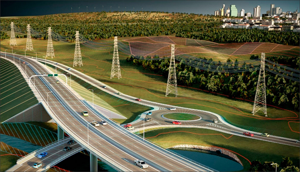
This article is focused on capturing the developments along the software front. As we will see, the field for BIM in infrastructure has expanded beyond the initial offerings that were limited to Autodesk and Bentley solutions. Let’s start by exploring these more recent offerings before going back to look at the solutions from Autodesk and Bentley for infrastructure design using BIM (Figure 1).
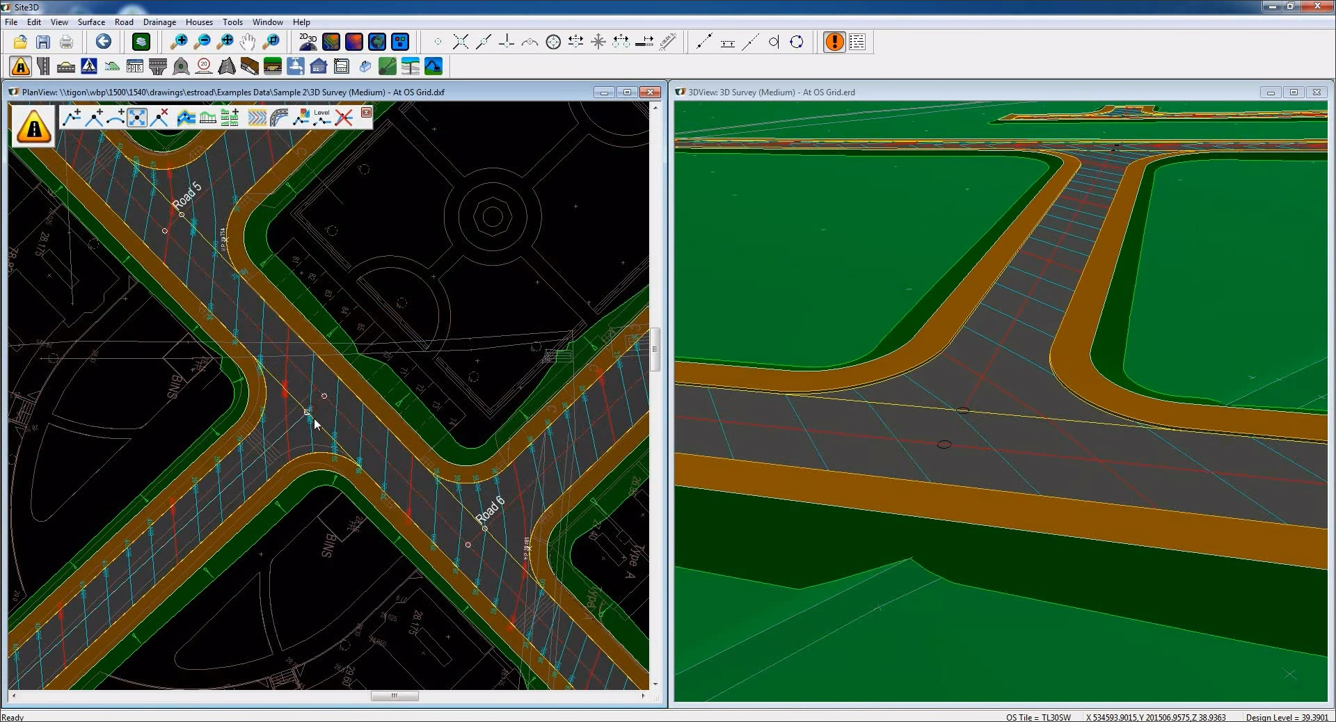
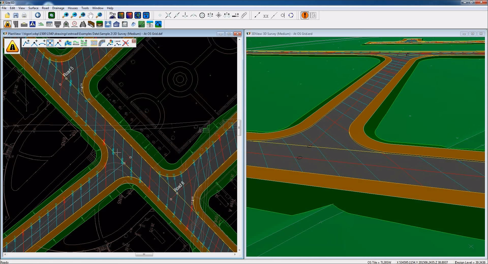
Site3D is a full-fledged 3D civil engineering design software developed with intelligent BIM objects, so advanced that I was surprised I hadn’t heard of it before. And it’s not even “new” as such—development on it started in 2003, many years prior to the launch of InfraWorks by Autodesk. Site3D is developed by a software company called Microplot in the UK, working in conjunction with its sister company, Wormald Burrows Partnership, a successful UK civil engineering consultancy. This helps to explain the capabilities and interface of Site3D which reflect an in-depth knowledge of civil engineering processes, the way engineers think about design, and the way engineers like to interact with software. Site3D has been in use within Wormald Burrows Partnership since its development in 2003, and it was made available for commercial use starting from 2014.
The product has a comprehensive set of capabilities for road systems (including long link roads, roundabouts, and junctions) and site design (including grading, drainage networks, ponds, earthworks, and volume calculations), all of which use model-based smarts to automate the design process. For example, if you change the road alignment line as shown in Figure 2, then all the details—the road's channels, kerbs, footways, laybys, junctions, interface slopes, sections, triangulation, and volume calculations—are instantly updated, and in all the views. Just as with BIM in building design, the software handles all the tedious and mundane details, allowing the engineer to focus on the high-level design intent. By making it easy to modify any aspect of the design model and have the knock-on effects automatically calculated and applied, the engineer can try out many what-if scenarios for the design and explore many different solutions quickly.
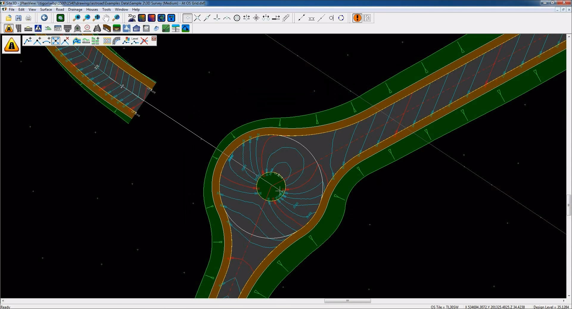
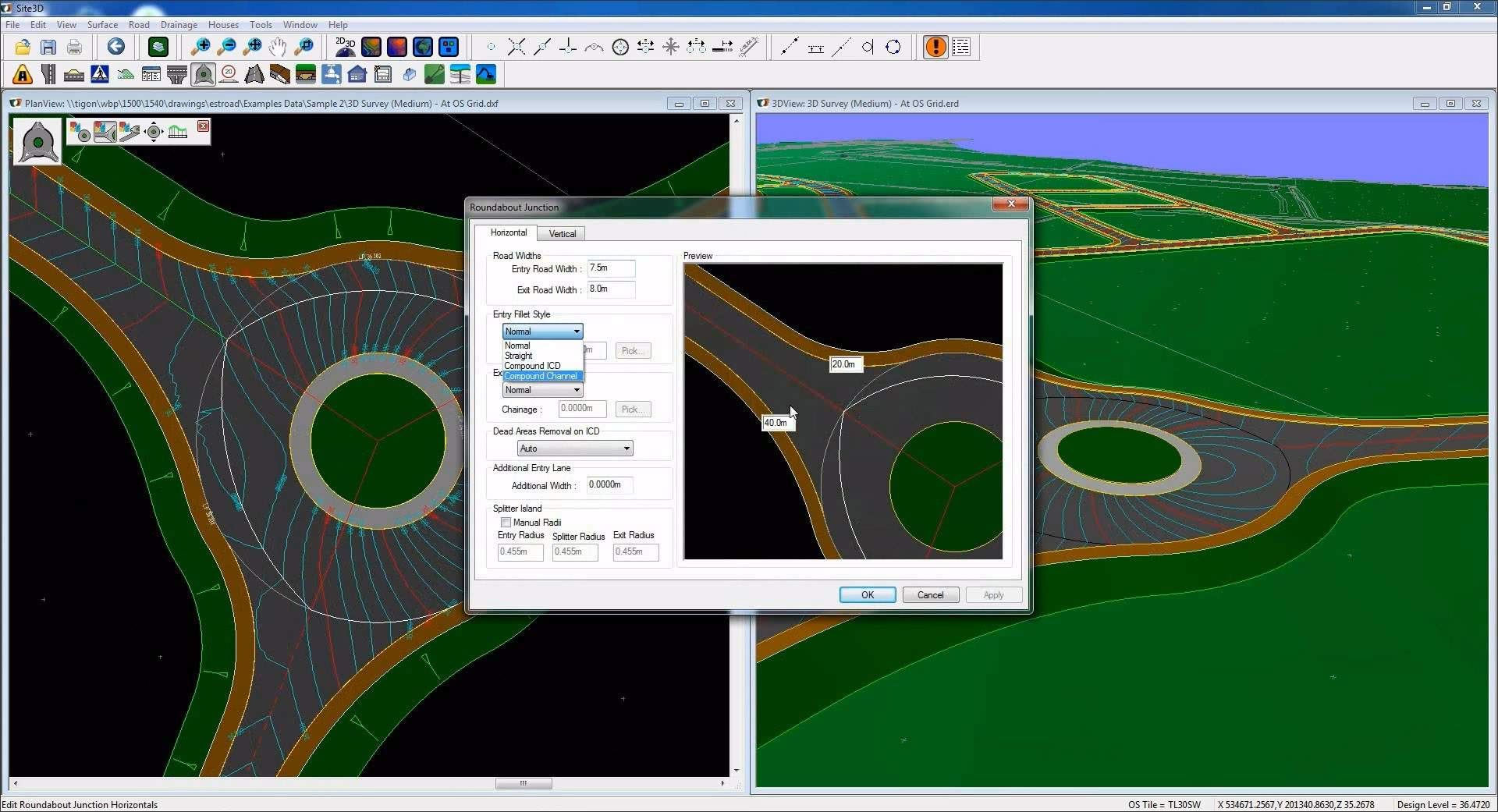
In addition to the use of BIM objects that carry information about themselves and understand their relationship to other objects, what enables Site3D to provide a high level of smarts and automation is that it incorporates many of the rules for infrastructure design, which come from its development in close collaboration with practicing engineers. An example of this in the design of roundabouts in shown in Figure 3.
Additional features of Site3D include the ability to import a wide variety of file types, a full set of CAD tools for creating detailed 2D documentation, and the ability to export the model to IFC format for integration with other BIM applications.
Another set of software solutions for BIM for Infrastructure is from a company called CGS Labs based in Slovenia, which has been in the market for 30 years and is supported by resellers around the world. In addition to being an authorized developer for both Autodesk and Bricksys, CGS Labs develops its own suite of high-end civil engineering applications for roads, railways, river engineering, and power lines.
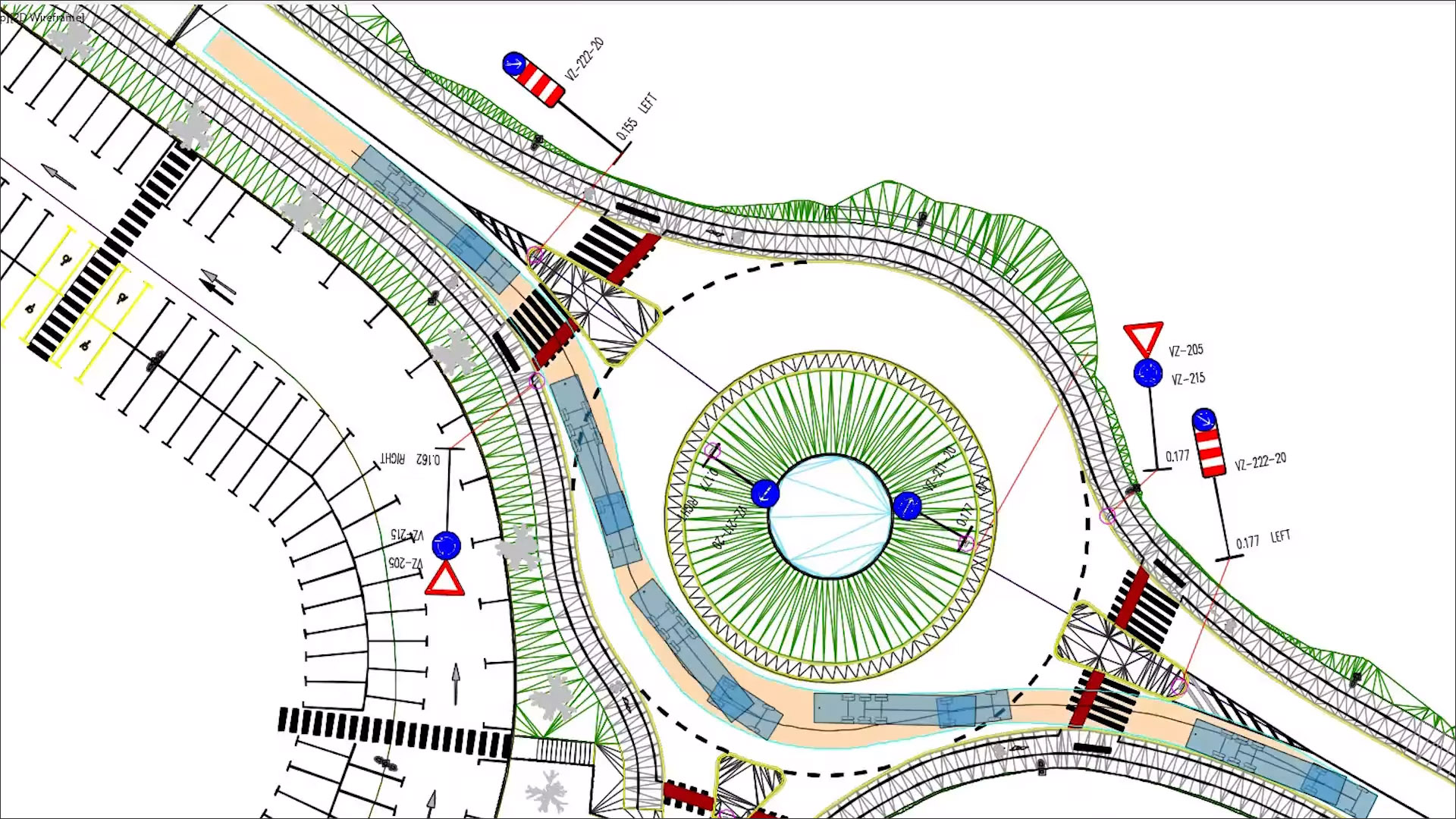
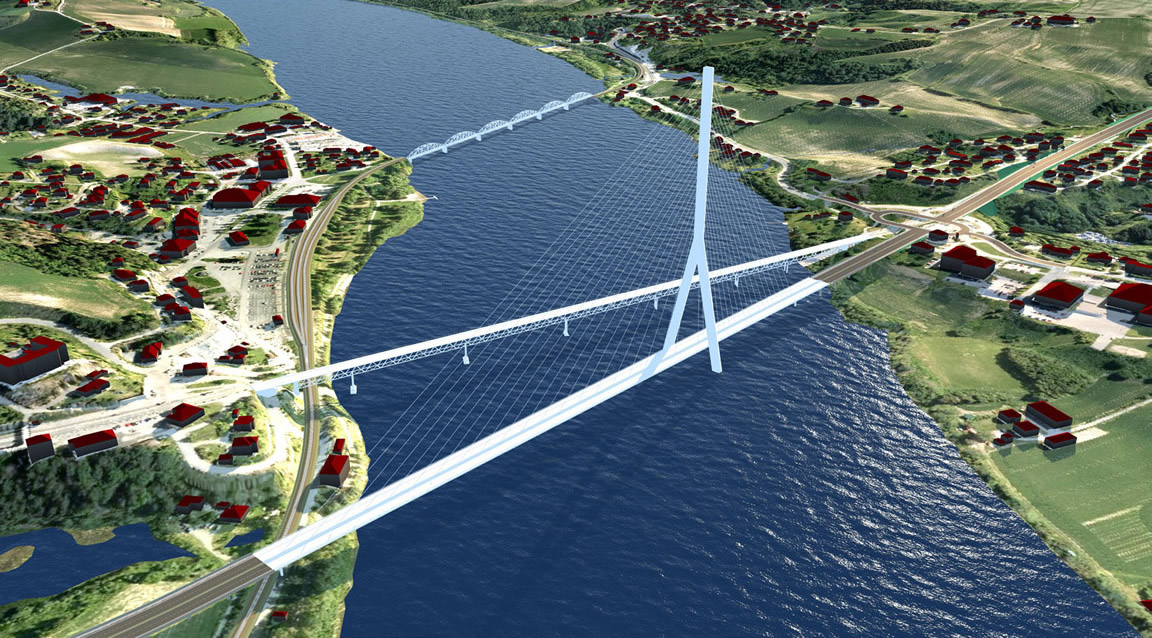
Of these, especially noteworthy from a BIM perspective are Plateia for 3D road design and reconstruction and Ferrovia for railway design and rail track analysis (Figure 4). Both applications include the tools to support the entire design process, from preliminary to detailed design. In the case of Plateia, this includes the initial input of survey data, to complex 3D road models with analysis tools, to documentation and publishing features. For Ferrovia, there are tools for rail track alignment and profile design, detailed cross section design and editing, and other rail engineering features.
CGS Labs refers to its solutions as BIM-ready rather than as BIM applications, which is an accurate description considering that they are primarily CAD solutions which have been enhanced with BIM capabilities and support BIM workflows and processes. All the elements are generated as detailed 3D solid objects with extended BIM metadata attached to them that is compatible with COBie (Construction Operations Building Information Exchange). The 3D models and attribute data can be exported to IFC files, and the IFC compatibility is regularly updated according to buildingSMART International specifications. The CGS Labs’ applications also include clash detection capability to search for possible collisions among selected 3D objects without requiring the models to be exported to external tools for clash analysis.
In contrast to CGS Labs, the company SierraSoft, which develops applications for land surveying, infrastructure design, and construction, unequivocally refers to them as BIM solutions. Headquartered in Italy and founded in 1998, SierraSoft’s applications are available in several languages including Italian, English, German, Spanish, Portuguese, and French, and are used in over 15 countries. In addition to including the main international standards for infrastructure design, they have also been adapted to comply with the specific requirements of the different countries in which they are used.
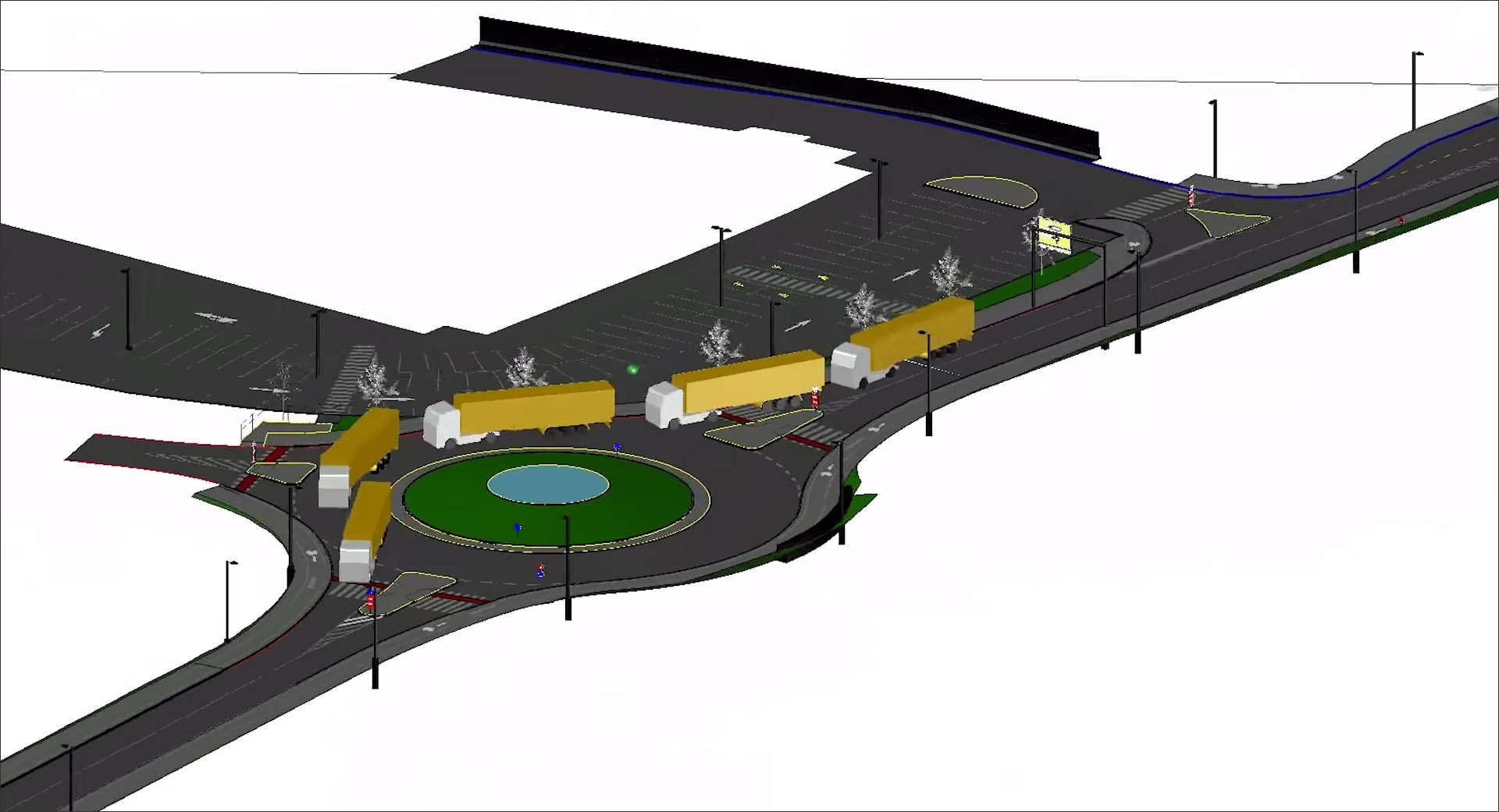
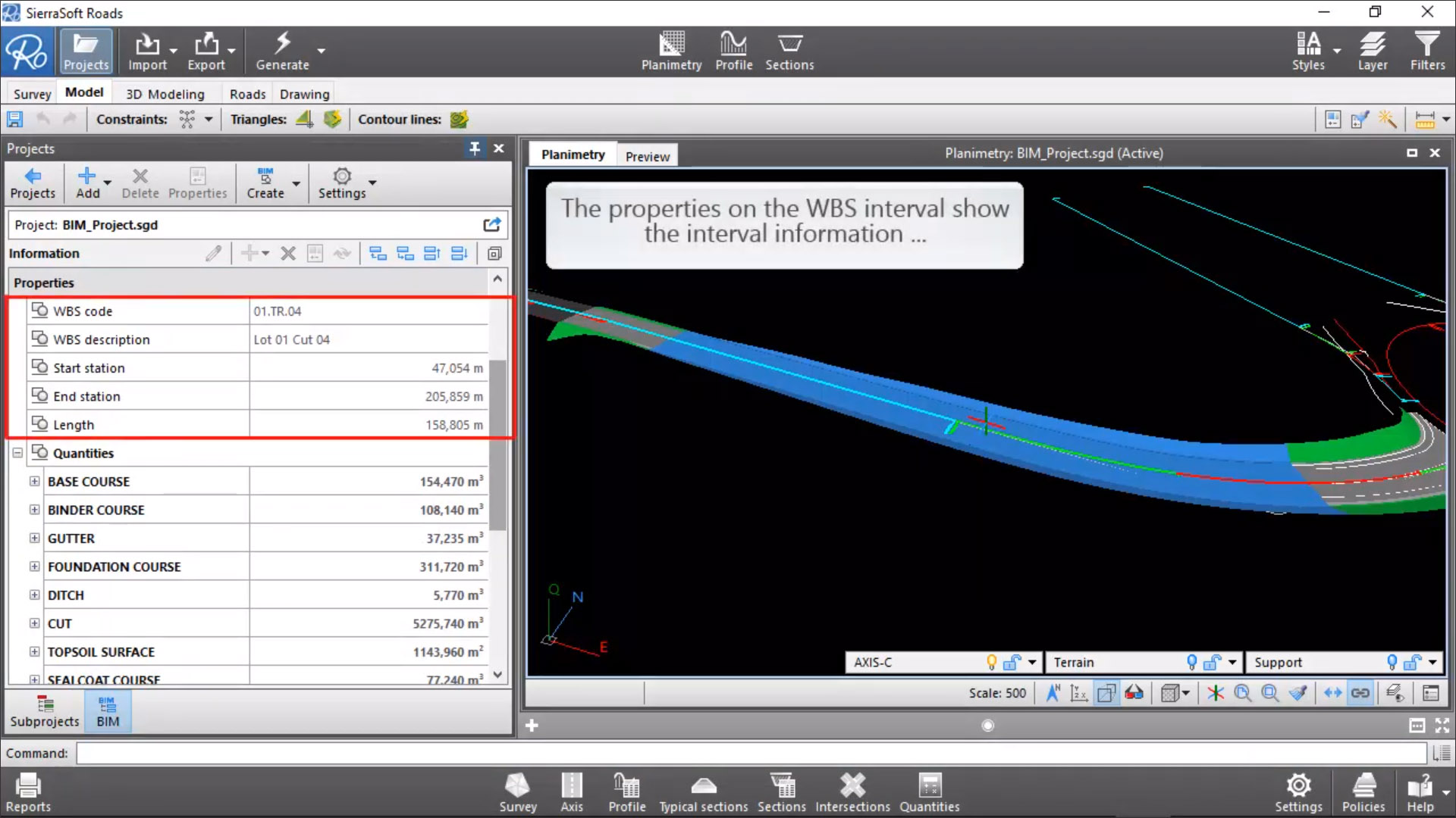
SierraSoft has two main BIM applications: SierraSoft Roads for the design of roads, highways, roundabouts, junctions, intersections, and any related features (Figure 5); and SierraSoft Land for land survey restitution and analysis, allowing land surveys of any size to be carried out with various types of tools such as total stations, GPS, laser scanners or drones. Additionally, it develops three extensions for enabling its BIM functionality: Information Modeling, for managing and structuring the information in the model; Interoperability, for allowing the information in the model to be exchanged for different use cases; and Analysis and Checking, for clash detection and code-checking. All these extensions are also sold independently.
In terms of the interface, I did not find SierraSoft applications any more BIM-like than those by CGS solutions—you are still for the most part, working in 3D, but with the ability to switch to a 3D view at any time and add BIM-related properties to elements.
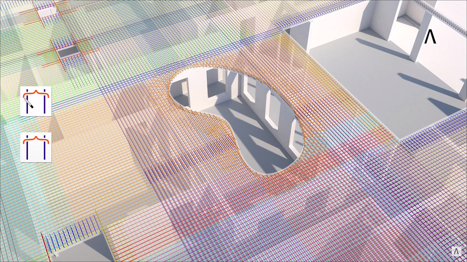
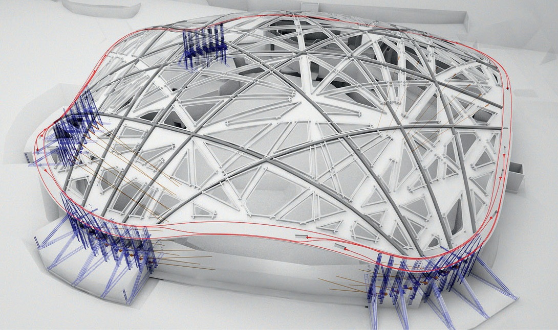
Allplan is the flagship BIM application from the publicly traded Nemetschek Group. Headquartered in Germany, Nemetschek is also the parent company of leading AEC applications such as ARCHICAD, Vectorworks, SCIA, RISA, Solibri, Bluebeam, dRofus, and Maxon. When Nemetschek was started in 1963, Allplan was its main product. It was subsequently spun off as a separate company (still under Nemetschek), and was expanded to include distinct modules for Architecture, Building Engineering, and Civil Engineering. The BIM capabilities of Allplan for building design were described in detail in my review of Allplan 2019. The infrastructure design application, Allplan Engineering Civil, has a similar set of tools and capabilities, except that they are targeted towards civil projects, enabling concrete structures with complex geometries to be fully modeled, reinforced, and detailed. In particular, the application has several innovations in the field of reinforcement for more precise placement and automation (Figure 6).
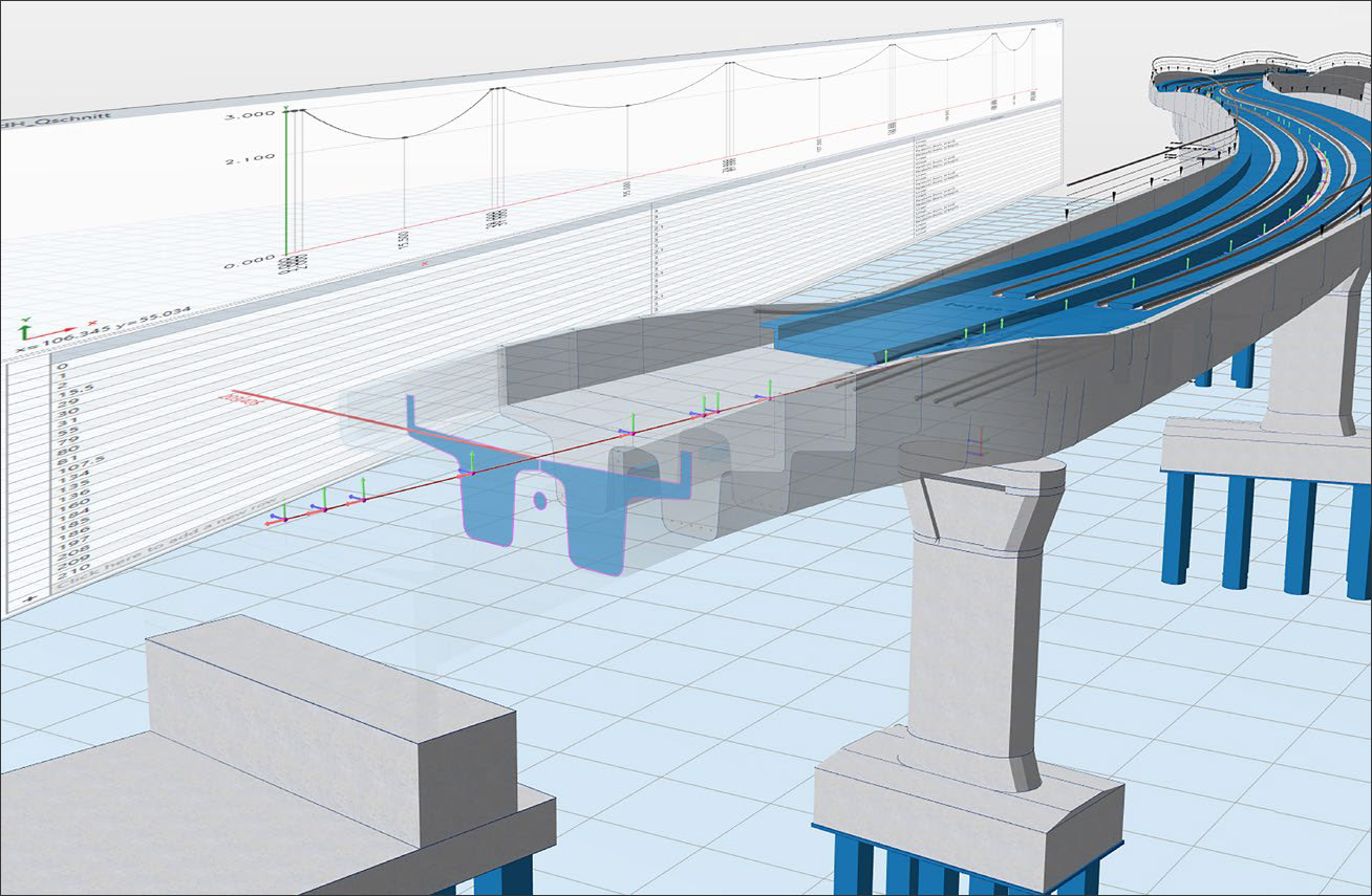
In 2019, the company introduced a dedicated BIM application for bridge design called Allplan Bridge, focused on the requirements of bridge engineers. Creating from scratch, it is indeed a “BIM-from-the-ground-up” application like InfraWorks, except that it is specifically for bridge design and allows models, even those with complex geometries, to be created with a high level of detail. The bridge model is defined by key parameters for its alignments and cross sections (Figure 7), allowing changes to be quickly made by tweaking their values, thereby making it easy to explore multiple options—the hallmark of a BIM application. In addition, there is support for a wide range of prestressing types and the automation of several key aspects to reduce the number of time-consuming and error-prone manual tasks. The application also includes structural analysis and detailing capabilities, allowing bridge engineers to do all their work within a single solution. Once the design has been created in Allplan Bridge, the model can be passed to the full Allplan environment where it can be further detailed and reinforced if needed.
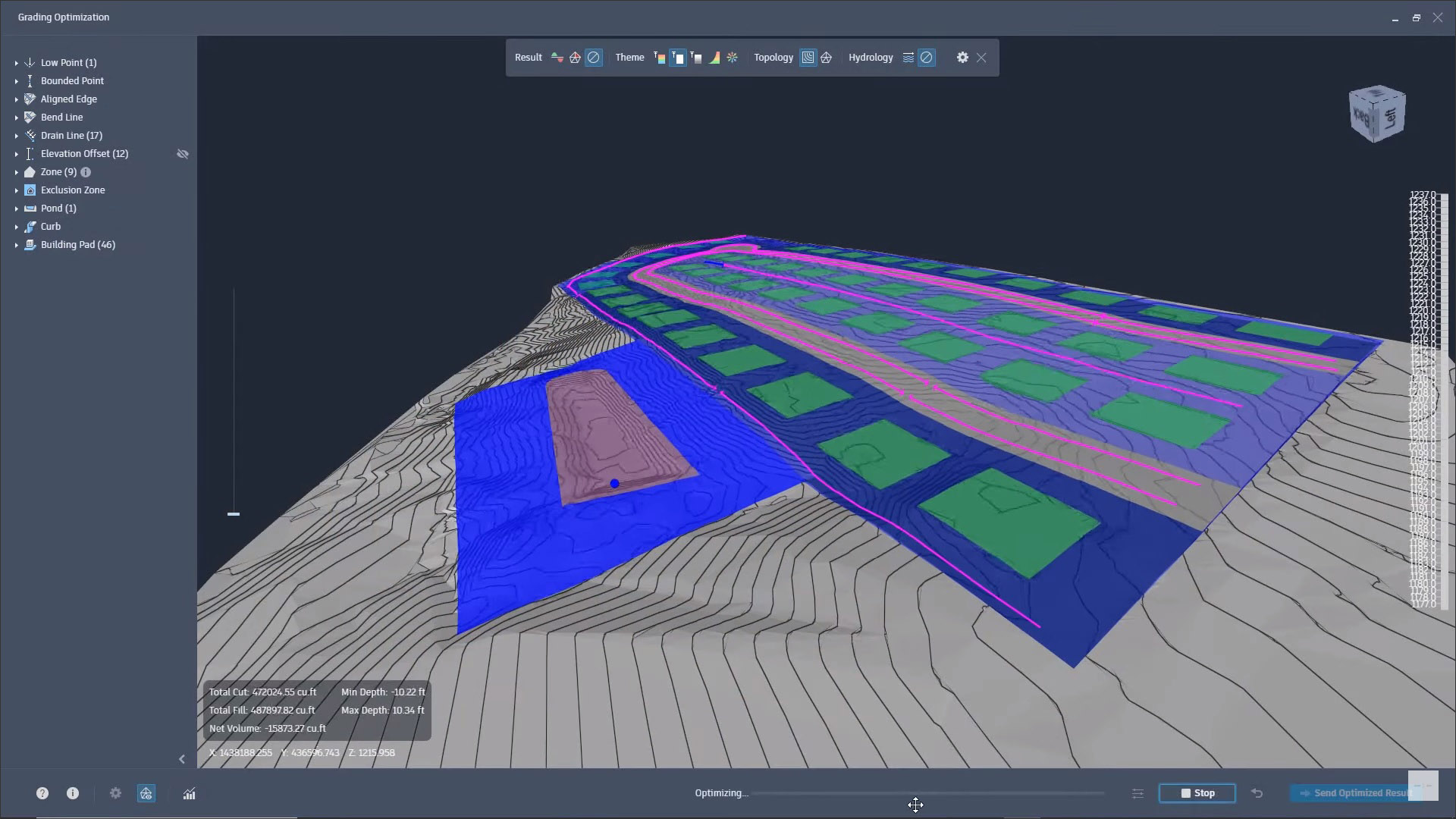
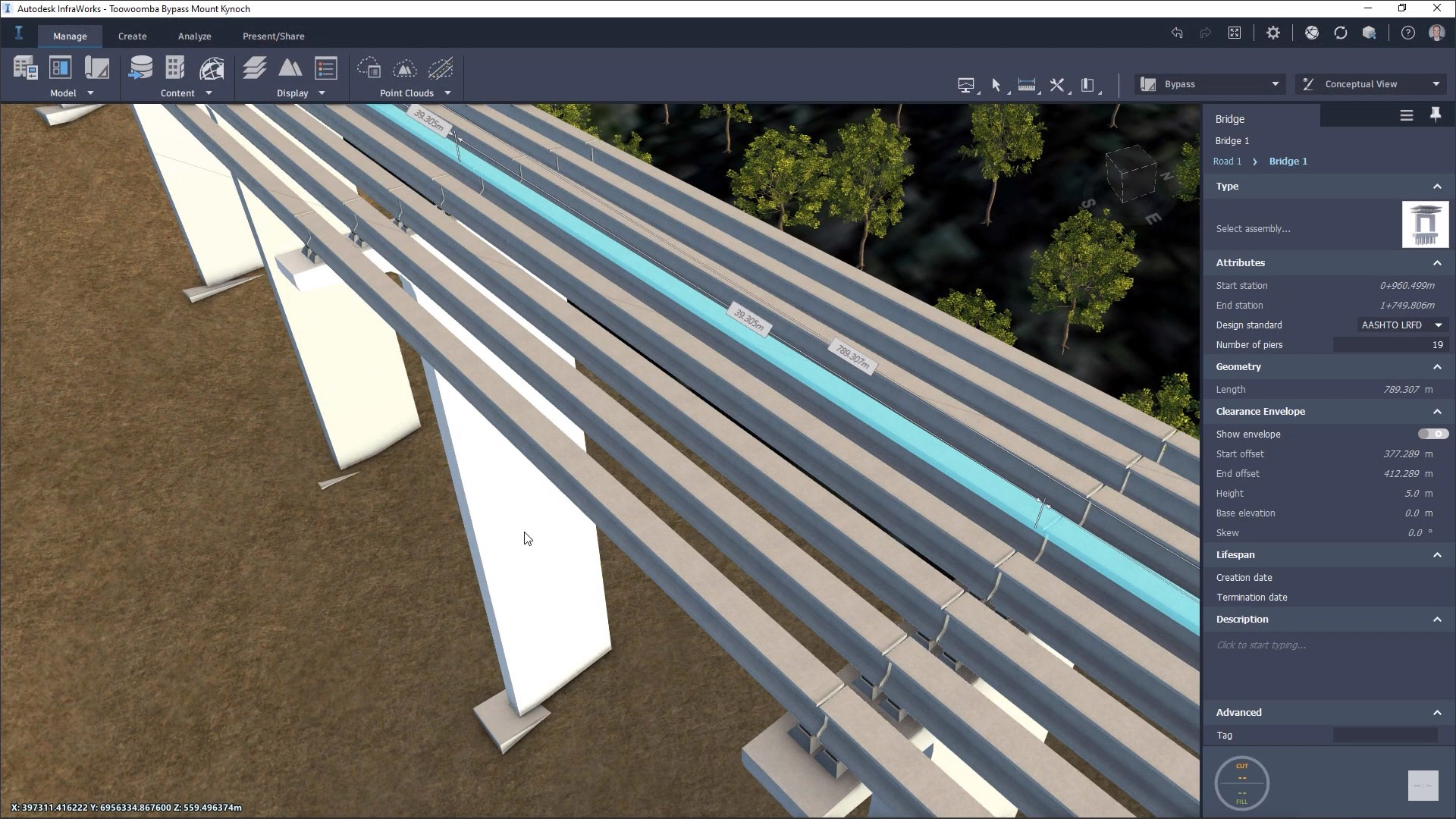
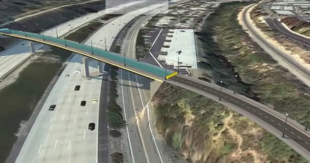
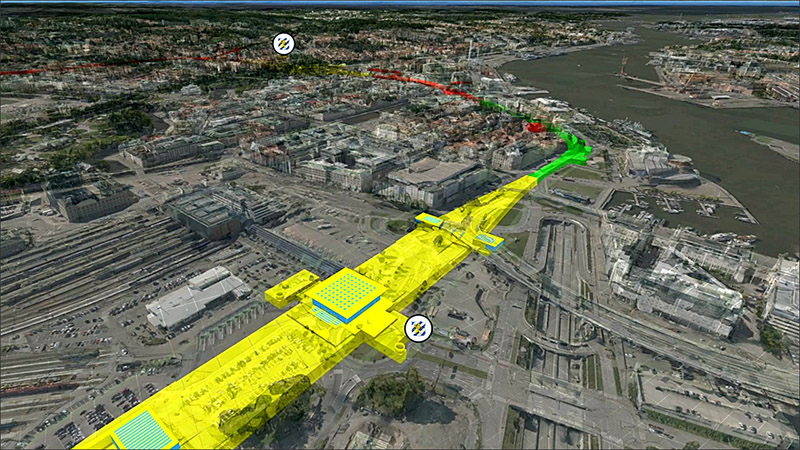
And finally, we have, of course, the solutions from the two leading vendors, Autodesk and Bentley. For Autodesk, the two main solutions in its infrastructure portfolio continue to be InfraWorks and Civil 3D, the former for conceptual modeling and visualization, and the latter for the detailed design and documentation of roadway, bridge, and rail projects. An overview of both these applications was provided in my 2014 “Extending BIM to Infrastructure” article, and while additional features have been added to them in subsequent releases, their fundamentals have not changed. That said, the annual updates continue to add to their smarts and capabilities, such as the automated site grading in Civil 3D (Figure 8) and improved bridge modeling in InfraWorks (Figure 9), both of which were introduced in the recent 2022 releases of the applications.
Bentley, in contrast to Autodesk, has a much wider array of infrastructure solutions as its focus has increasingly shifted from buildings to infrastructure, evidenced by its annual “Year in Infrastructure” conferences (see the articles on the 2020 and 2019 events). Bentley has dedicated BIM applications for each infrastructure discipline include OpenRail, OpenRoads, OpenSite, OpenBridge, and OpenFlows (water, wastewater, and stormwater), along with additional applications for more specialized industries. Bentley’s infrastructure portfolio has been further strengthened in recent years by acquisitions such as SITEOPS, a site optimization tool that has been integrated into OpenSite (Figure 10); LumenRT, for high-end visualization of infrastructure designs with animated traffic; CUBE, for transportation and land-use modeling; and Streetlytics, for citywide analysis of vehicular and pedestrian travel.
BIM in Infrastructure has been slow in taking off, and the field is not exactly flush with software applications as BIM for Buildings is. That said, many of the BIM applications that have been developed for buildings such as structural analysis, multi-disciplinary coordination and clash detection, pre-construction, costing, scheduling, construction management, etc. can just as well be applied to infrastructure, so there are not as many obstacles to implementing BIM in Infrastructure as one might imagine. BuildingSMART is already working on expanding the IFC format to include infrastructure elements (see the recent article, “An Overview of buildingSMART Standards”), and BIM is starting to be implemented by both infrastructure firms as well as government agencies in many countries across the world (as we will see in a forthcoming article).
The fact that so many of the applications for BIM in Infrastructure, as profiled in this article, are being developed internationally is also promising and should help to jumpstart the efforts of the countries where they are based. The world is always going to need new and updated infrastructure, so there is a lot of potential for good infrastructure design software. The more, the merrier. The smarter, the better.Lachmi Khemlani is founder and editor of AECbytes. She has a Ph.D. in Architecture from UC Berkeley, specializing in intelligent building modeling, and consults and writes on AEC technology.
Have comments or feedback on this article? Visit its AECbytes blog posting to share them with other readers or see what others have to say.
AECbytes content should not be reproduced on any other website, blog, print publication, or newsletter without permission.
This article explores the application of BIM's “information modeling” concept to infrastructure, where all the components are represented by intelligent data-rich 3D models that carry information about themselves and their relationship to other components.
The Viewpoint article questions why we still don’t have a smart building design tool which does not require us to painstakingly model every detail in our buildings, but can automatically create much of it from a conceptual sketch using a rule-based expert system.
Enhancements include a new Planes palette for managing the building structure of the project, the ability to create freeform 3D surfaces and use them as reference planes, a new Stair Modeler tool, a brand-new dedicated add-on for parametric bridge design, and several other features.
This article discusses key topics from YII 2020, including digital twins, digital cities, Bentley’s upcoming iTwin Platform and its strategic partnership with Microsoft, and the updates to Bentley’s applications for design integration and project delivery.