


A few months ago, I wrote about the SmartBRIDGE Hamburg project as an example of an actual digital twin in action, one of the few in which the emerging digital twin technology has actually been implemented. As the technology is further developed, we are likely to continue seeing more implementations, both for individual buildings and infrastructure assets, as well as for neighborhoods, regions, and cities. For the larger-scale implementations, the vision is similar to what I had described in my article on “City Information Modeling” six years ago — designing and operating cities more intelligently, efficiently, and effectively, with the ability to simulate various aspects such as traffic, congestion, energy, impact of natural disasters such as earthquakes or hurricanes, flood control, etc. (It is worth noting that that digital twin technology hadn’t even been invented at that time!)
Since the emergence of the technology and its potential application in the AEC industry (see the paper, “Digital Twins in AEC,”) we have seen some traction on the application of digital twins at the urban-design level, including IES Intelligent Communities Lifecycle (ICL), which is being developed as a digital twin for the sustainable design of communities; Bentley’s Digital Cities initiative built on its iTwin platform; and Cityzenith’s Smart World platform, which started out as an CIM (City Information Modeling) application, but is now labelled as a “Urban Digital Twin Technology” application.
This article describes another promising initiative in the application of digital twin technology at the city level: the DUET project.
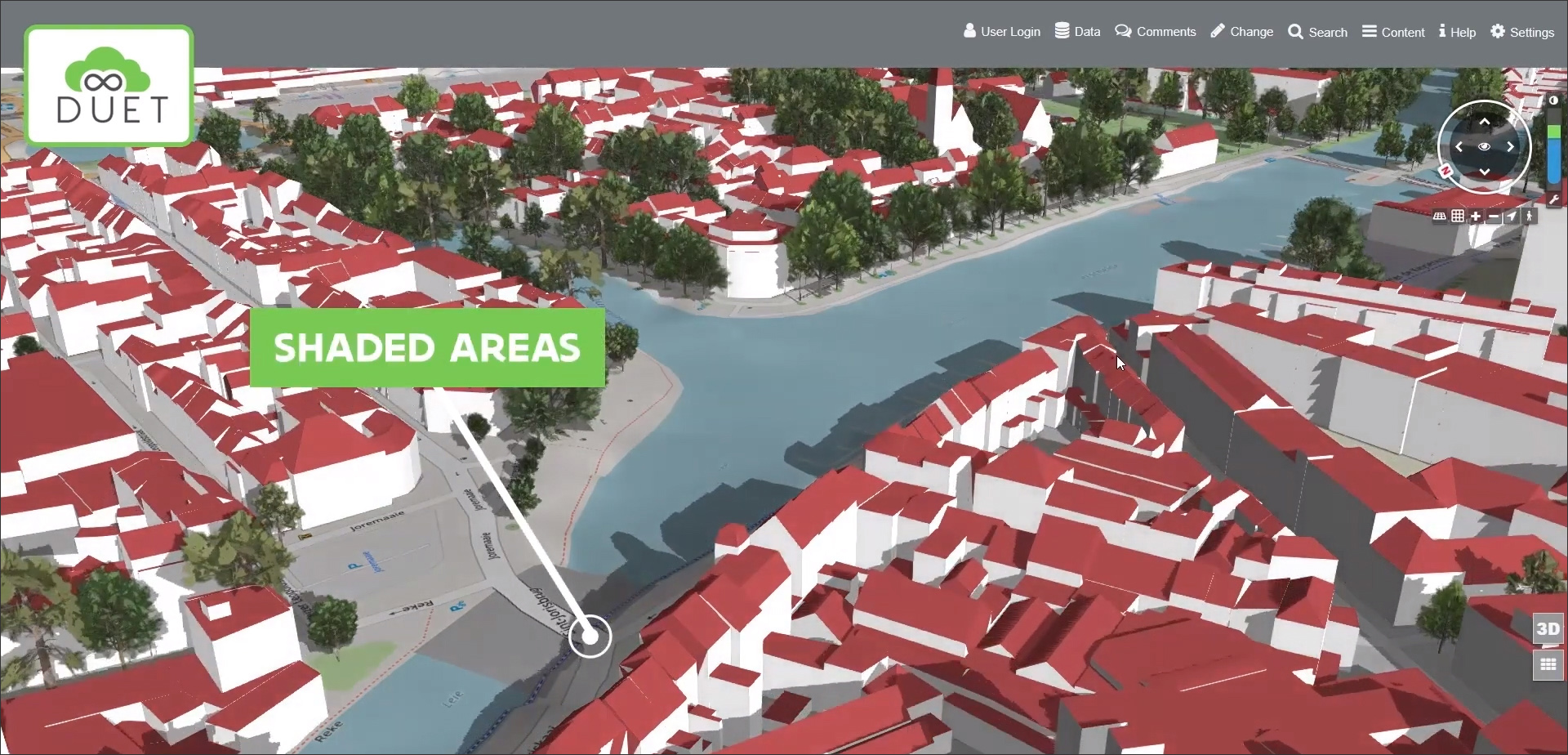
The DUET (Digital Urban European Twins) project, as the name suggests, is focused on creating digital twins — i.e., virtual replicas — of cities in Europe to allow them to be better designed, operated, and managed. It is an innovation project funded by the European Union Horizon 2020 Research & Innovation program with the main objective of improving urban policy making in cities by allowing city officials to understand the real-world impact of changes before making crucial policy decisions. Ideas can be tested virtually on the digital twin before implementing them in reality with different kinds of what-if analysis, for example, exploring the shading patterns in a region before commissioning outdoor seating in pedestrian areas (Figure 1). Additional benefits of the project that could follow include greater transparency in decision-making; better communication with the public on the day-to-day operation of the city, which in turn can encourage citizens to get more involved; and breaking down the silos between the different government agencies involved in the city’s administration and improving collaboration between them.
Several organizations across Europe with a variety of backgrounds are involved in the DUET initiative, including city officials, academics, researchers, data modeling professionals, and technical specialists in digital twins. One of the key technology partners is Virtual City Systems, a commercial company that develops 3D city models and provides associated urban planning and urban simulation solutions. It is providing its deep domain-specific technical expertise to the DUET project and has developed many of the features of its digital twin platform. In fact, it was in a recent webinar hosted by Virtual City Systems that I was able to learn more about the DUET project.
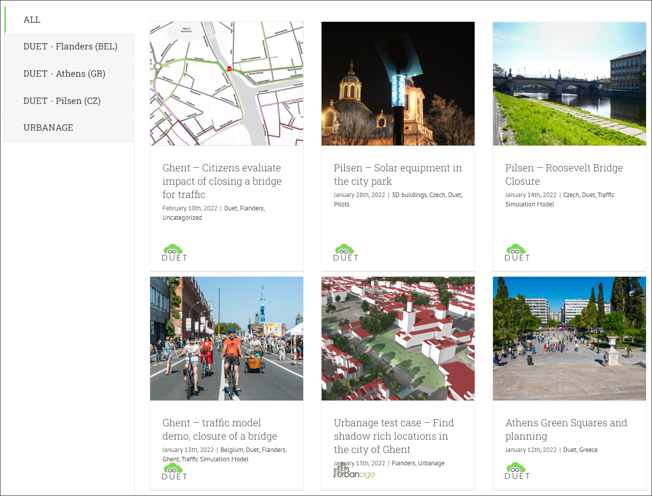
The current implementation of the project includes a base platform in which different sets of city data can be pulled in, including maps, topology, 3D models, traffic, weather, noise, etc. As proof of concept, pilot implementations have been done for three European cities: Flanders, Belgium; Athens, Greece; and Pilsen, Czech Republic. For each city, different use cases have been implemented, for example, the impact of a bridge closure in Pilsen, finding shaded areas in Ghent (a province of Flanders) to locate outdoor seating (shown earlier in Figure 1), studying air pollution in Athens, etc. A full list of the use cases that have been implemented so far are shown in Figure 2 and can be explored at https://citytwin.eu/.
The key difference between a BIM model and a digital twin, in the case of a building or infrastructure asset, is that a BIM model is static while a digital twin is dynamic, always in sync with the physical object it is “twinning” through the use of sensors, IoT devices, reality capture devices, cameras, etc. (See the recent research paper “ A Digital Twin for a Health Care Facility using IoT and Edge Computing Devices” published in AECbytes.) In the case of a much larger and more complex entity like a city, the digital twin is even more involved as it needs to not just be a digital replica of the physical objects in the city — and in sync with them at all times — but also tie in the many systems and processes that underlie the city and how it operates. Examples include traffic, utilities, weather patterns, zoning, permitting, postal delivery, refuse collection, fire departments, policing, irrigation maps, etc., and so on.
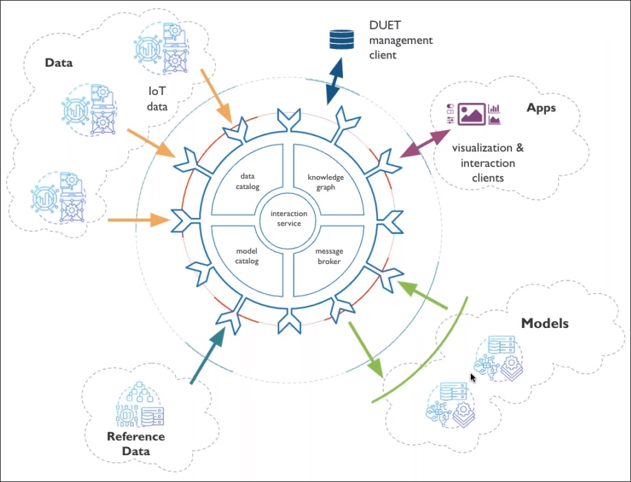
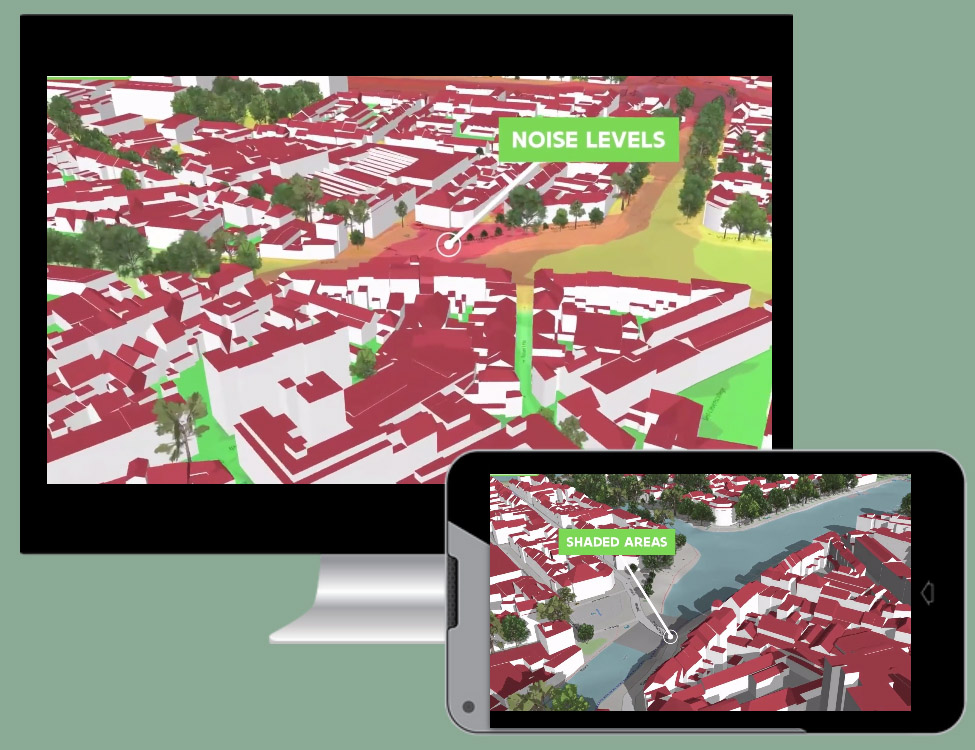
The technology platform that has been built for the DUET project takes this data diversity into account with an open, flexible, and scalable configuration, shown in Figure 3. At the core of the platform are the components that manage the different data sets and models, the interrelationships between them, and the various modes of communication, both within the platform as well as the interaction with the user. At the outskirts of this core platform, more loosely coupled but still an integral part of the digital twin, are additional components including the different data sources such as IoT, traffic, noise, temperature, pollution, etc., that will be needed for the different use cases that the platform is addressing; reference data such as maps, road networks, and weather information; models, both geometric and analytical, that not only provide inputs to the platform but also take in outputs relevant to them (for example, a change in the traffic model will impact the air quality model and will therefore be picked up by the latter); and the applications for visualization and communication with the users of the platform on both computers as well as mobile devices (Figure 4).
While this was only a high-level overview of the technological underpinnings of the DUET project (a more detailed explanation is at https://www.digitalurbantwins.com/technical-approach), what is important to note is that the platform is extensible and allows more data to be integrated into it in the same manner as the current data sets in the sample implementations. And the more the kinds of data that are integrated, the wider the array of use cases that can be tackled. So, for example, if a list of recommended cycling routes in a city are to be displayed, it would require data on all the available bicycles lanes as well as data on cycling accidents to determine which routes are the safest.
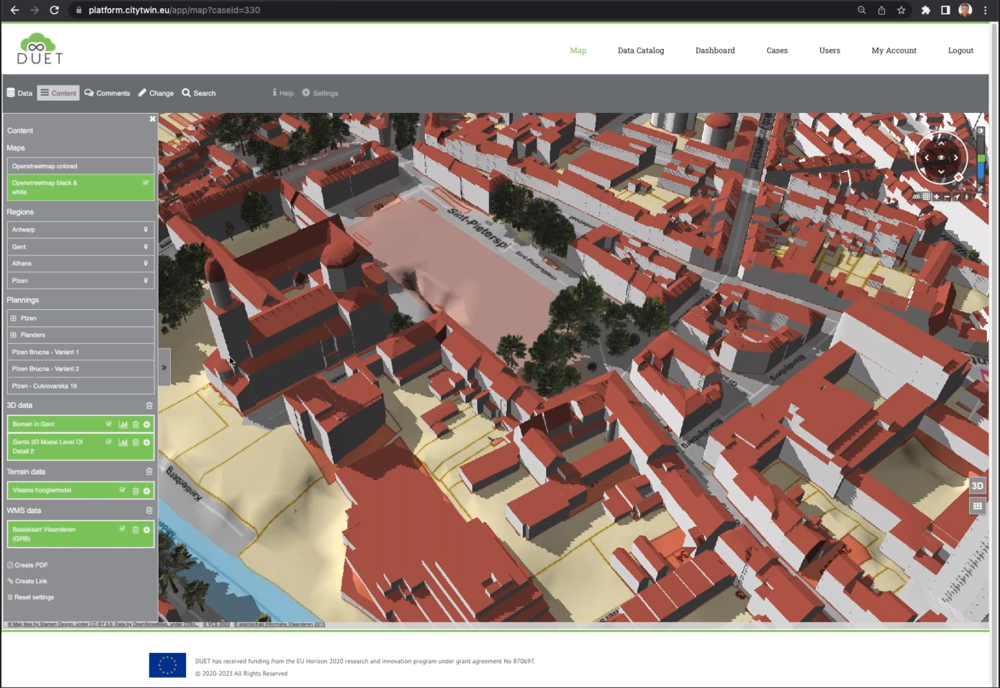
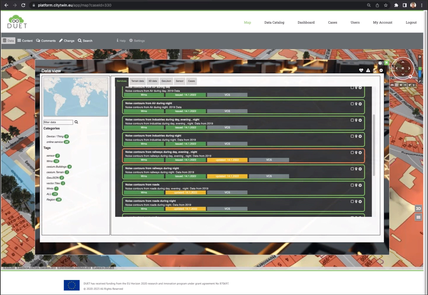
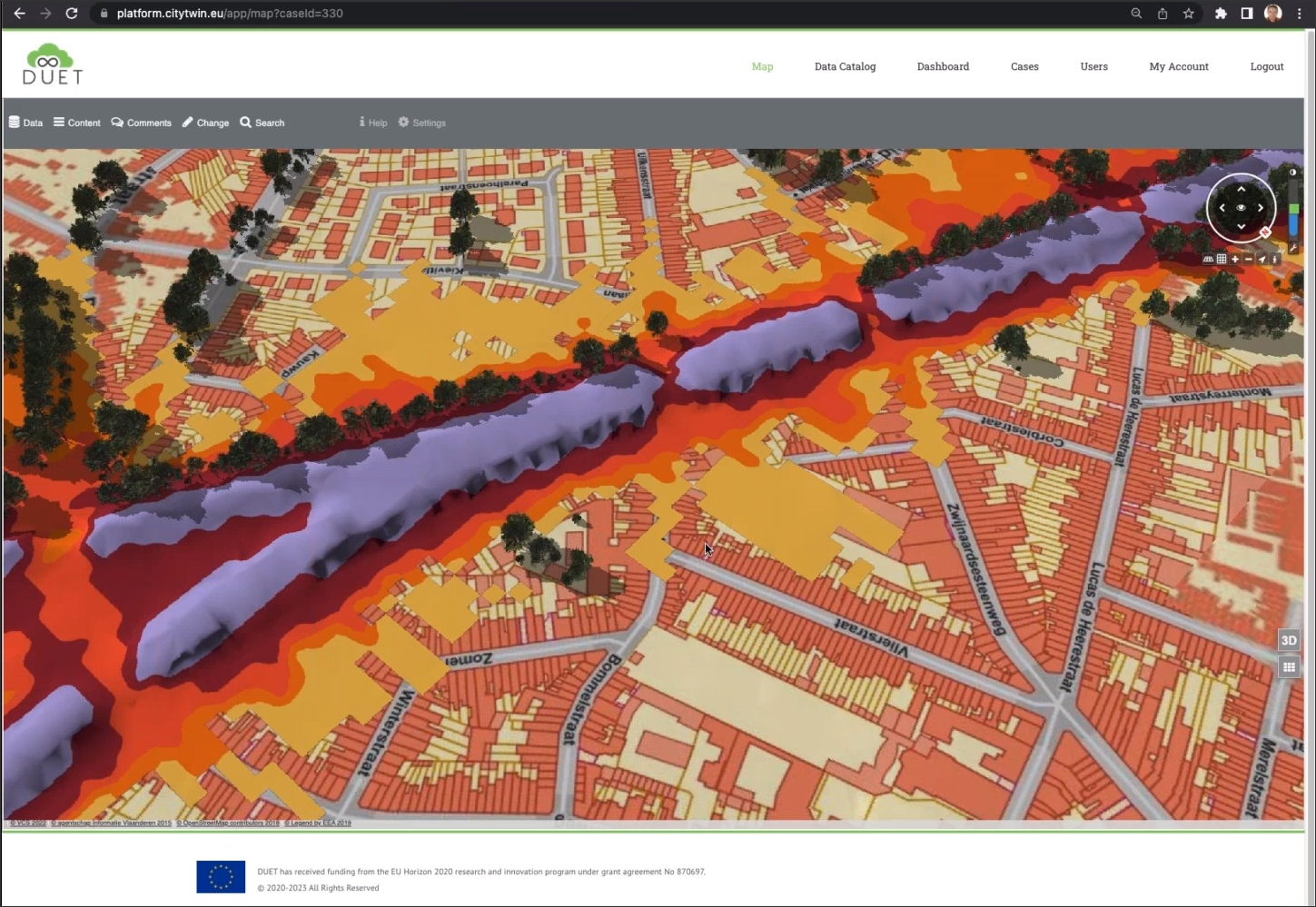
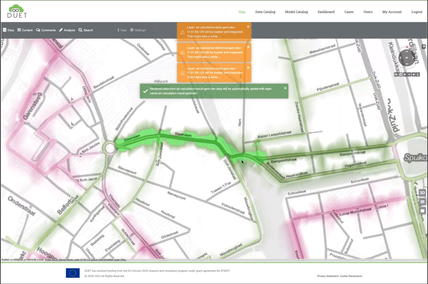
The DUET platform is cloud-based and accessible through a web browser, and it provides the option to turn on and off content from a panel on the left of the graphical viewer, as shown in Figure 5. Given that it can be used to connect to many different data sets, there is also the option of selecting exactly what data to load into the current implementation depending upon the kind of analysis being done. For example, Figure 6 shows a “noise contours from railways” data set being activated, which is subsequently visible in the viewer.
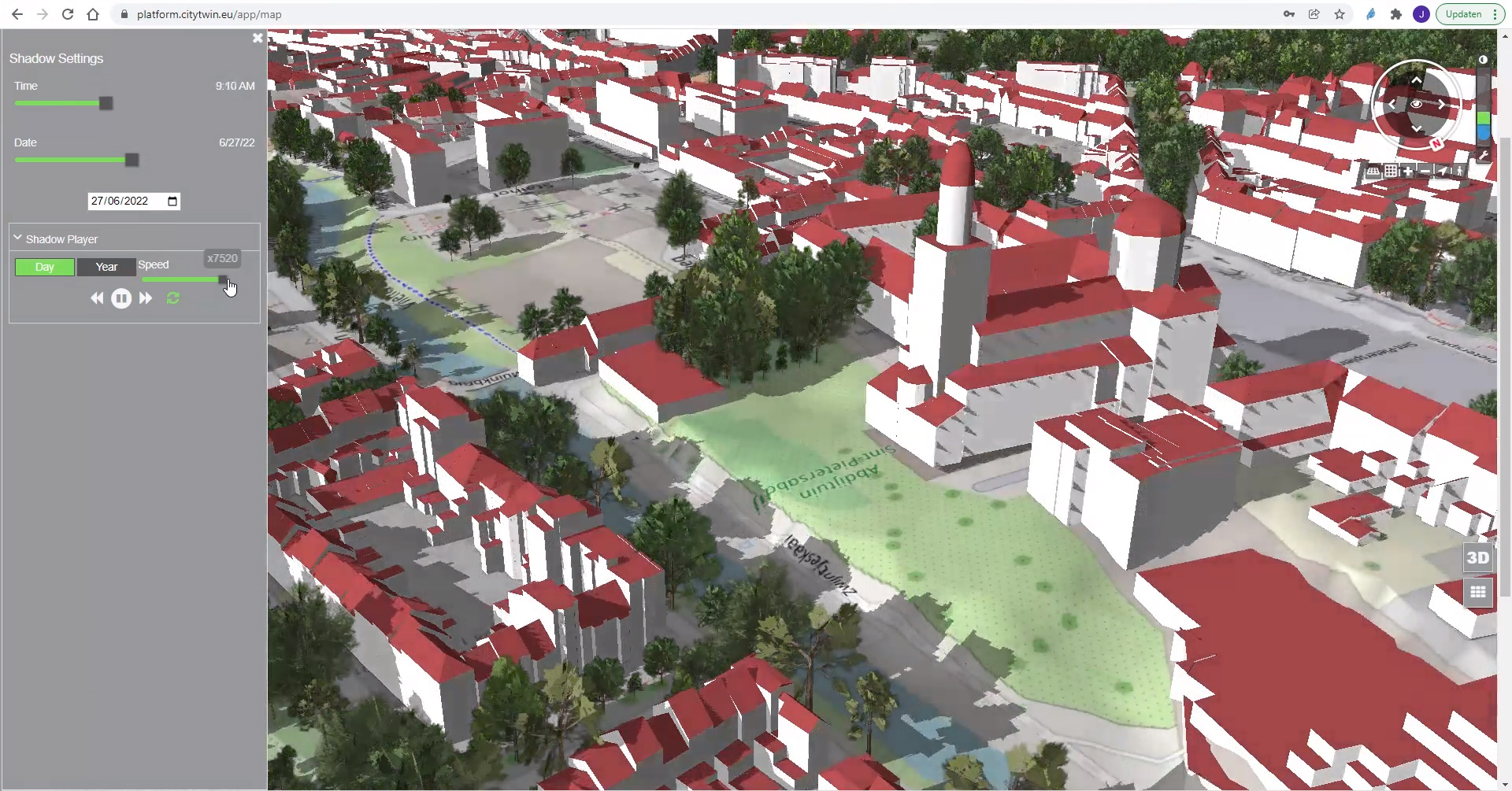
Earlier in Figure 2, we saw the DUET prototype implementations that have been completed so far. One of these is a partner European project called Urbanage that is focused on improving the life of quality of senior citizens, based on smart city data. It is using DUET to detect comfortable, shadow-rich places inside the city where senior citizens can seek refuge on extremely hot summer days as well as determine at what time their favorite bench will be covered by the shadows of nearby trees and buildings. The implementation of this use case on the DUET platform is shown in Figure 7. The navigation wheel on the upper right corner of the graphics window can be used traverse the city and locate a specific spot. The user can then open up the shadow settings panel, shown on the left, and move the sliders to specify the time of day and the date to get an accurate simulation. The implementation also allows users to place a marker or a specific location and add a comment to share them with others.
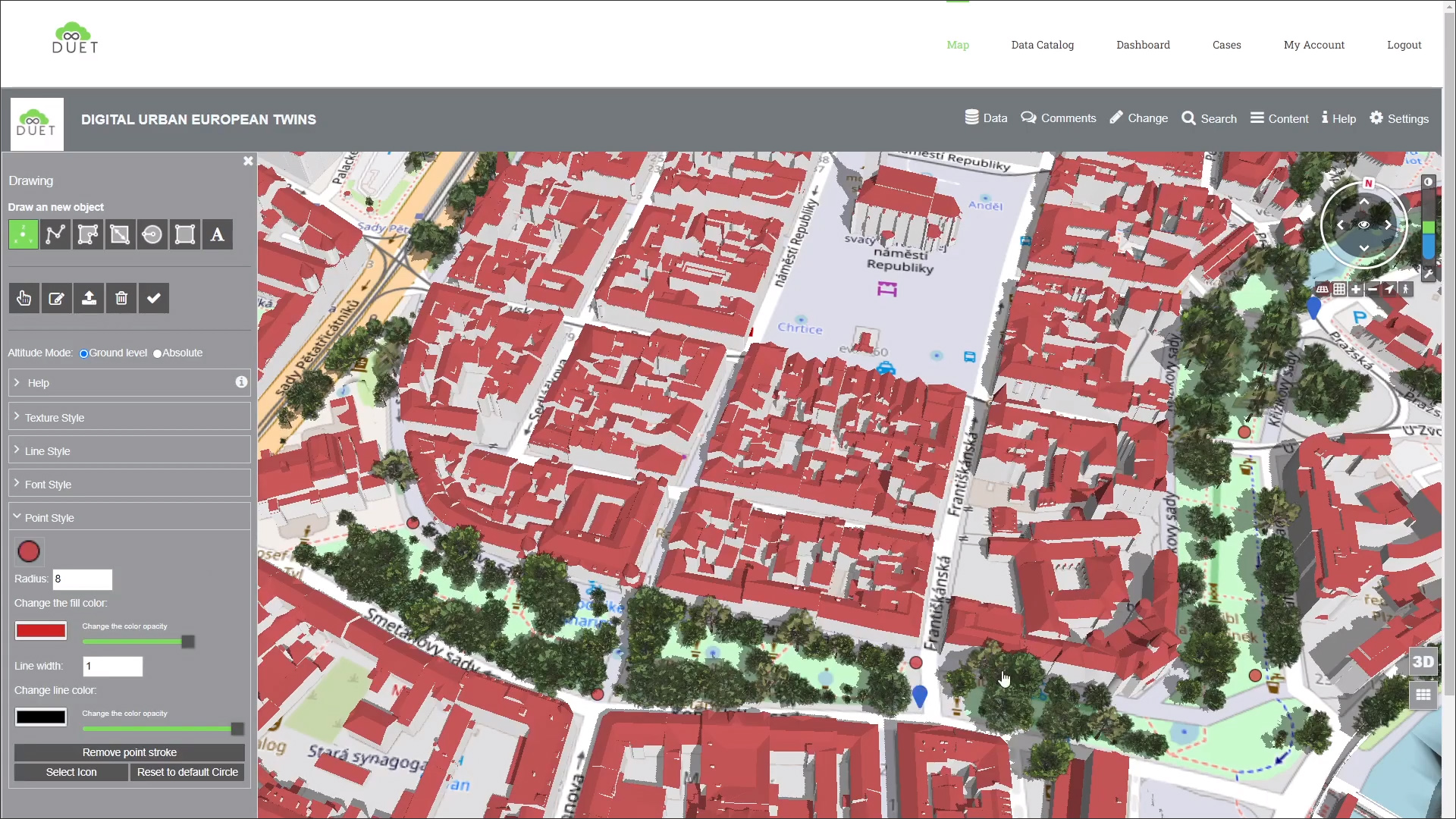
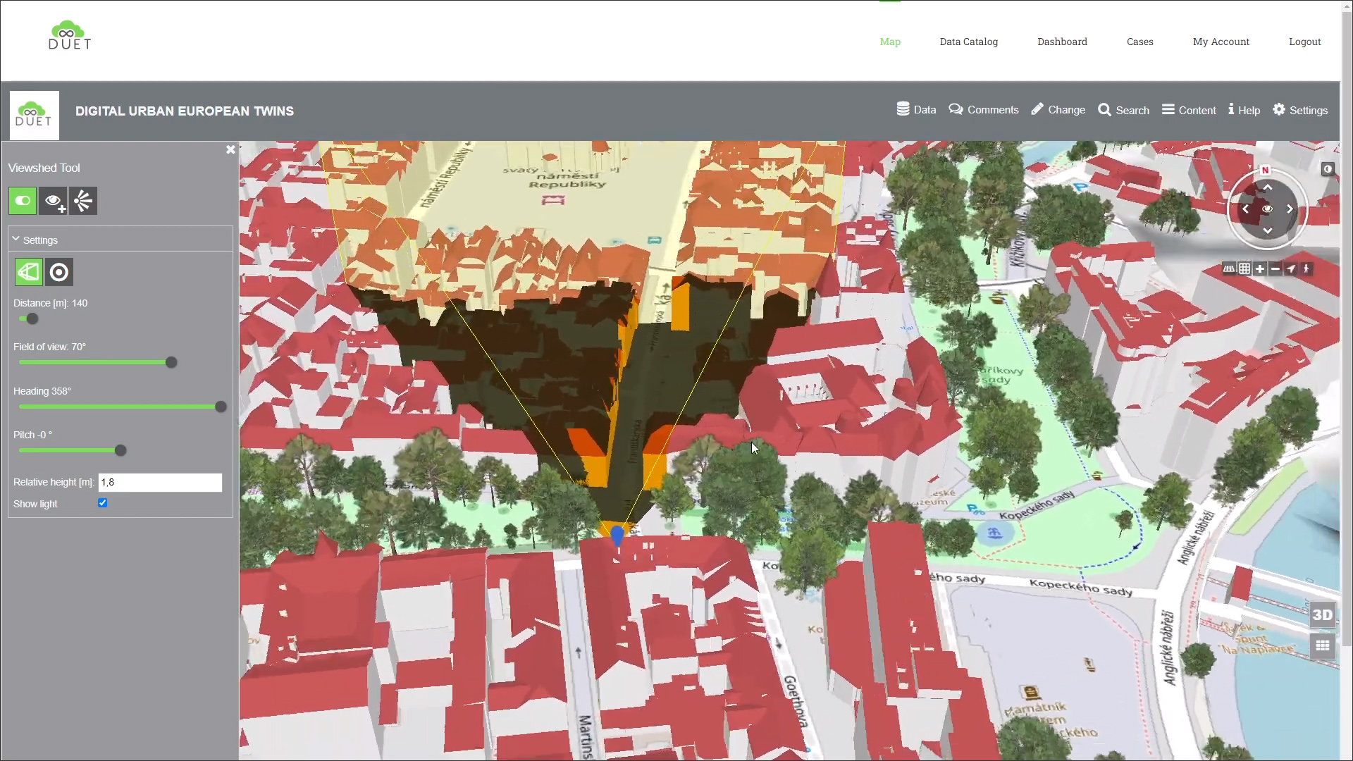
Another use case, also related to shading, is installing solar equipment in a park in the city of Pilsen. The equipment that the city wanted to install included benches, cameras, parking meters and potentially other smart devices, and since it did not want to build any additional electrical infrastructure, all of the devices had to be solar-powered. Therefore, it was necessary to place the devices or their external solar panels in locations with sufficient sunlight. Also, in the case of cameras, it was important to find ideal locations for their installation with regards to the field of view. The DUET platform was used for both these requirements: identify locations with sufficient sunshine for the installation of the solar equipment (Figure 8); as well as identify locations with a suitable field of view for the installation of cameras (Figure 9).
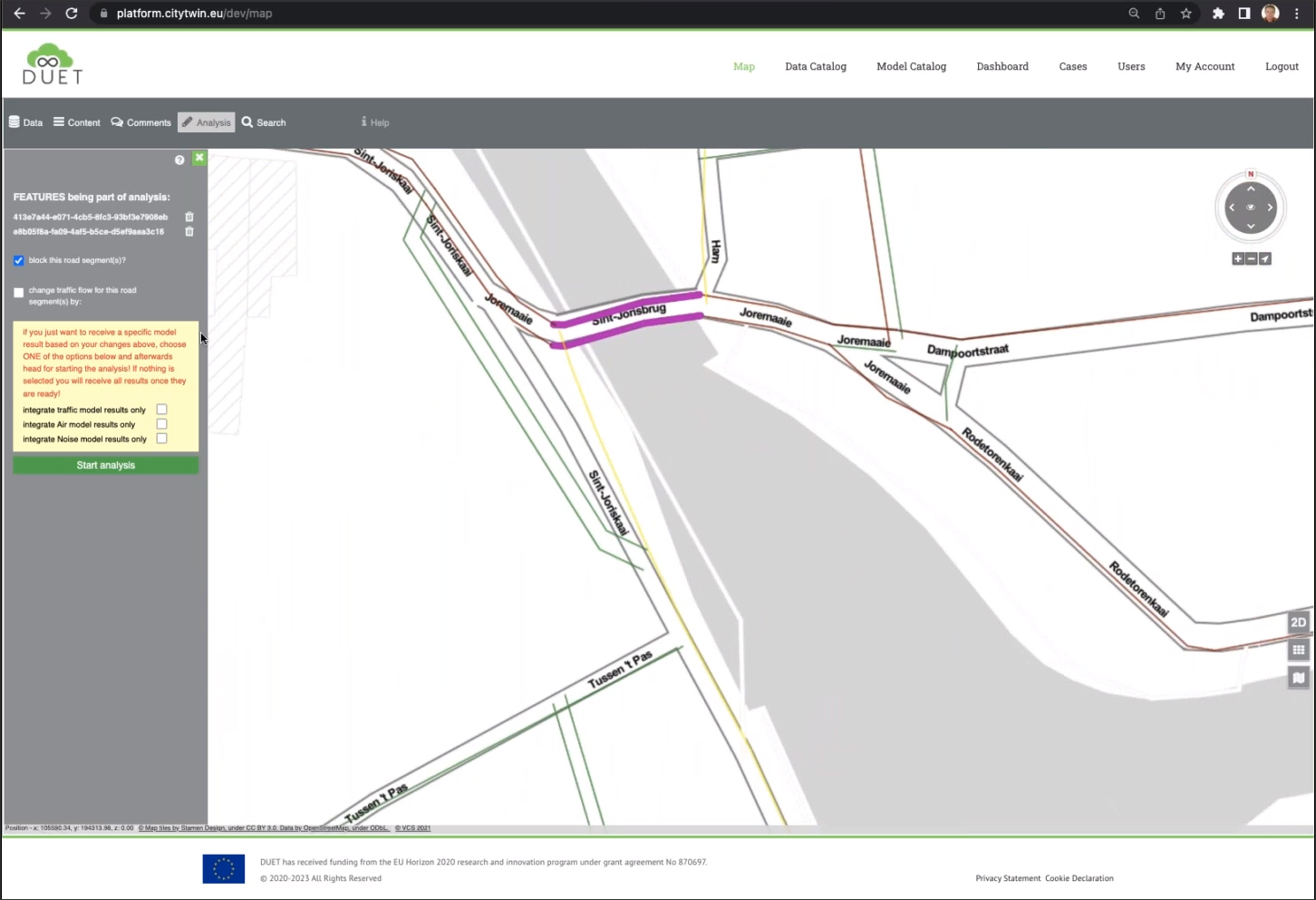
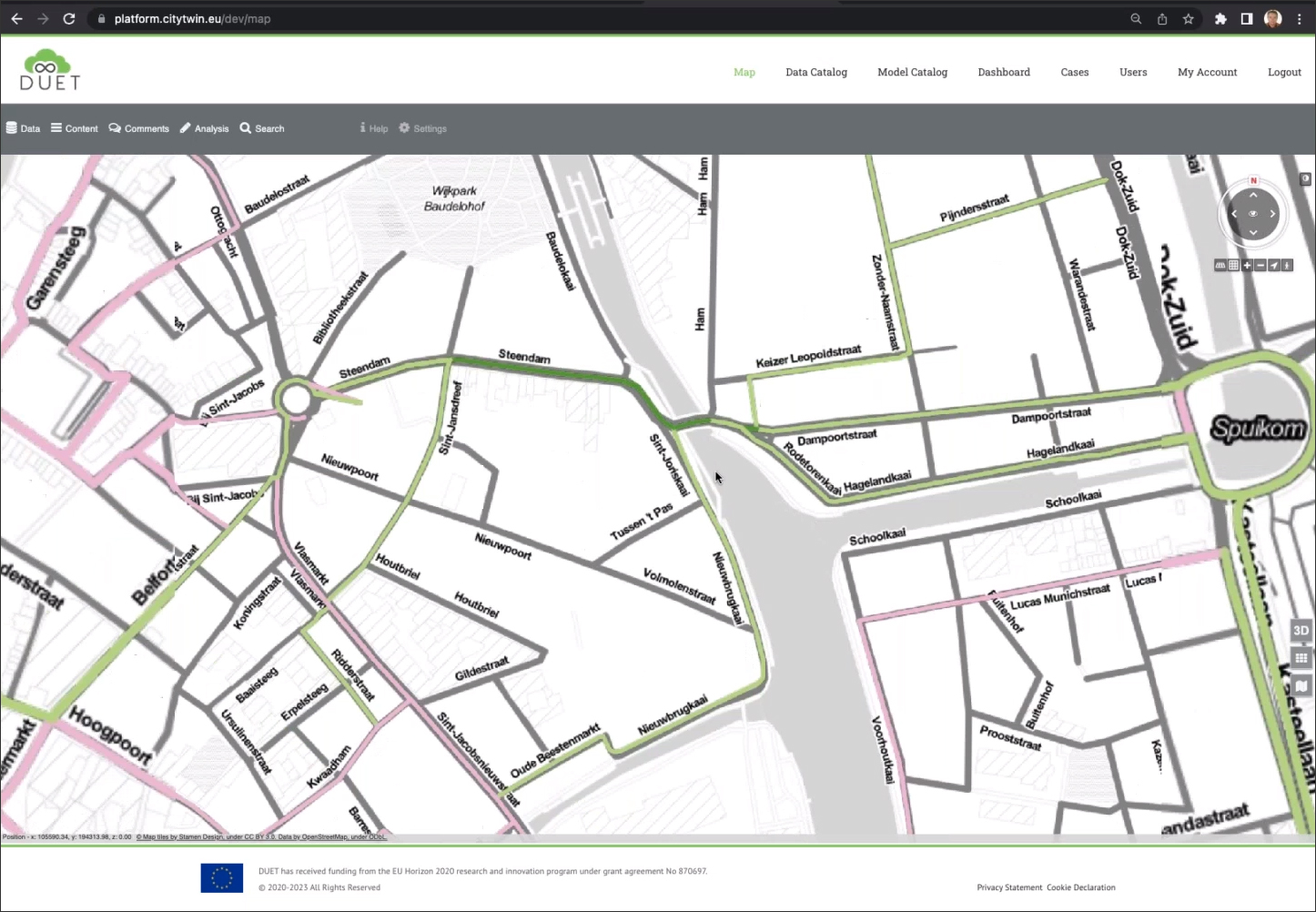
Another more complex implementation that demonstrates the power of the DUET platform, especially its ability to enable what-if analysis, is predicting the impact on traffic that the closure of a bridge would have in the city of Ghent. This implementation required connecting DUET to the traffic model of Ghent. The idea is that an expert can block the traffic on a set of roads and let the model calculate the impact on the other roads in the area. The before and after traffic can be displayed, as well as a delta map showing the streets that have increased and decreased traffic (Figure 10). In addition to the traffic re-routing resulting from the closure, the platform is also able to provide the impact of the change on noise and air pollution by communicating with the air and noise models respectively (Figure 11).
An interesting statistic related to city planning is that 80% of the data that is relevant for policy making is unused today. The objective of the DUET project is to change that by creating a platform — using the rapidly advancing technology of digital twins — where more of the city data that is available can be brought in, visualized, and analyzed to make better informed decisions that can improve the life of its citizens. While the DUET project is still at the prototype phase with a limited set of use case implementations, it has been developed to be scalable, so that many more use cases can be addressed by bringing in additional data to the platform.
A project like DUET serves as a good model to demonstrate how digital twins can be created and used to improve how cities are designed, managed, and operated, paving the way for other cities, not just in Europe but all over the world, to create their own digital twins. There are already a growing number of “smart city” initiatives in many countries, with the digital twin technology being a key enabling factor. Just as smart phones are now ubiquitous and we are starting to see more smart homes, at some point we will, in all likelihood, be living in smart cities that can make daily life easier and more efficient for its inhabitants.
The only real question is how long it will take.
Lachmi Khemlani is founder and editor of AECbytes. She has a Ph.D. in Architecture from UC Berkeley, specializing in intelligent building modeling, and consults and writes on AEC technology.
Have comments or feedback on this article? Visit its AECbytes blog posting to share them with other readers or see what others have to say.
AECbytes content should not be reproduced on any other website, blog, print publication, or newsletter without permission.
The AEC industry has gone from manual drafting to CAD, then from CAD to BIM, and now from BIM to digital twins. This paper explores the technology of digital twins and its potential in the AEC industry to go much further than BIM in terms of impact and benefits.
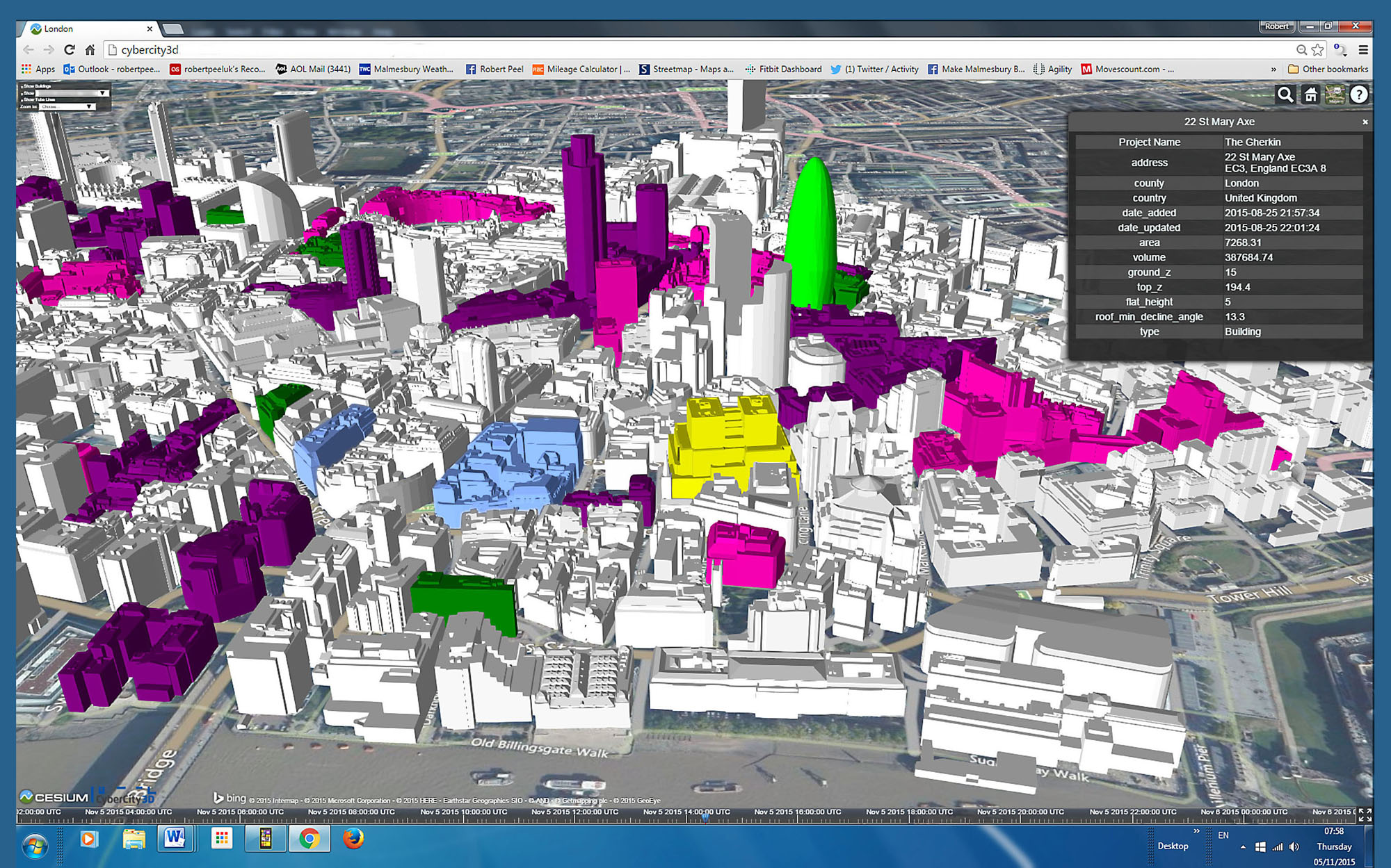
Exploring the solutions for “city information modeling” from BIM stalwarts such as Autodesk and Bentley to CIM-specific companies such as virtualcitySYSTEMS, Cityzenith, SmarterBetterCities, CyberCity 3D, and Agency9. Also, how is CIM different from the concept of “Smart Cities?”
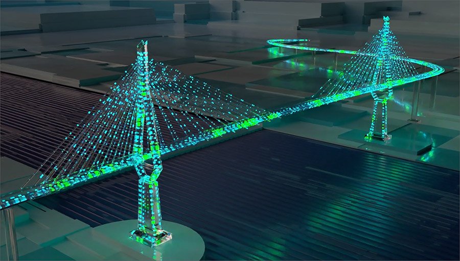
This article describes the digital twin of the Köhlbrand Bridge in Hamburg, Germany, which was developed with the objective of enabling predictive maintenance of the bridge rather than the conventional reactive maintenance that is ubiquitous for buildings and infrastructure.
How will Digital Twins and Smart City programs change the way projects are designed, built, and managed? Ron Perkins, who has more than three decades of experience in the AEC technology industry, explores this question.