


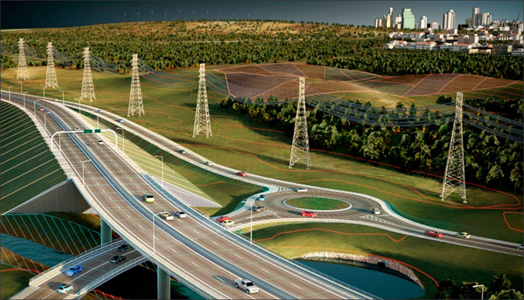
From a technology perspective, the gap between buildings and infrastructure in AEC is continuing to narrow as BIM goes from being a tool primarily for building design to also being used for infrastructure design. At the same time, bringing the larger context into the building design process is also becoming increasingly important to determine how well a proposed building design fits into the site, how it interacts with the surroundings, how it impacts the microclimate in the neighborhood in which it is located, and vice versa (Figure 1). In short, having an accurate model of a region is critical, not just for the design of the infrastructure assets within it but also for the design of buildings that are located in it.
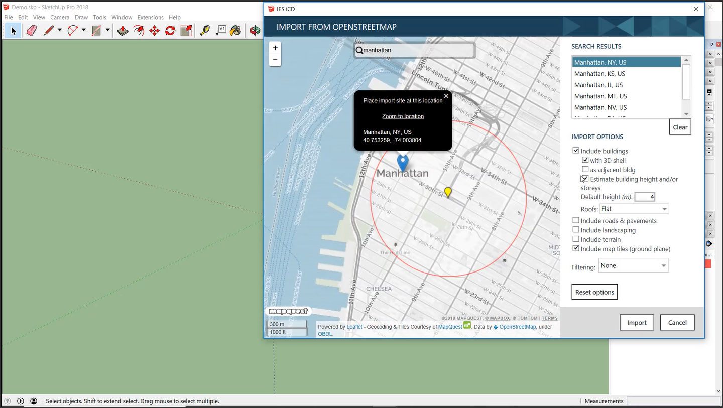
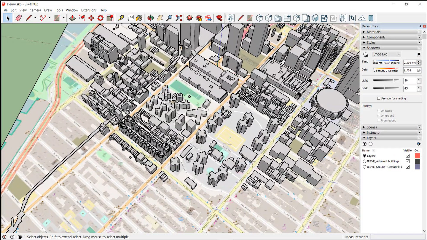
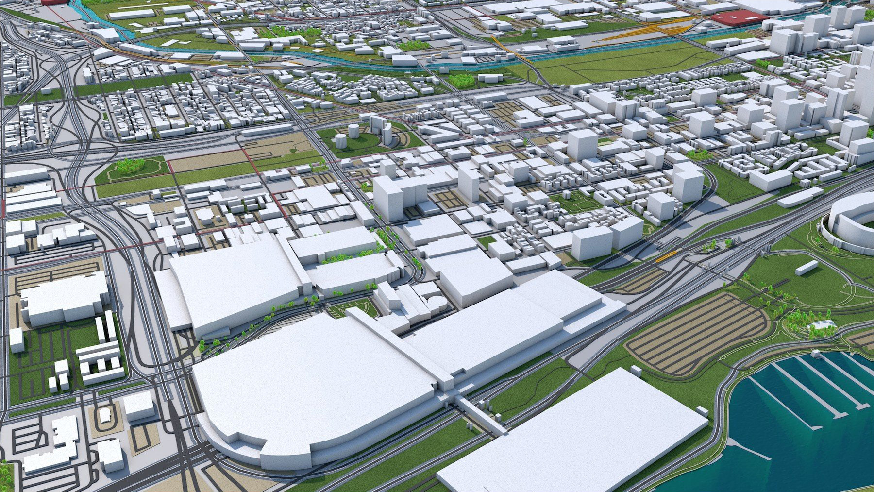
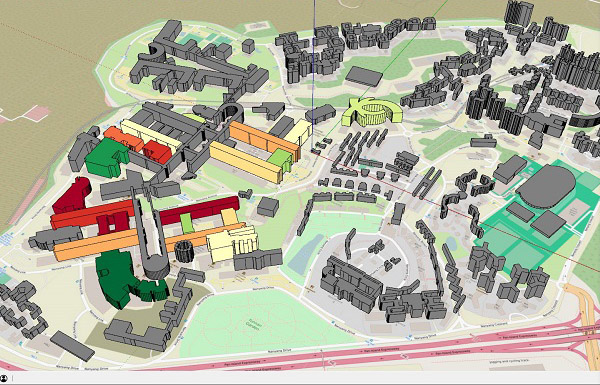
The most common way to get an accurate model of a region is to use a GIS map of it. In addition to the location of roads, buildings, open spaces, and additional terrain information, the map also, in many instances, has the heights of the different structures located in the region, making it possible for some tools to automatically create 3D models from a selected area of the map. An example of this was described in my review of "IES Intelligent Communities Lifecycle (ICL)" showing how an area in OpenStreetMap could be selected using a plugin and converted to a 3D SketchUp model (Figure 2). Another example from the article "Extending BIM to Infrastructure" showed a similar capability available for Autodesk InfraWorks using a tool called Model Builder — you select an area in OpenStreetMap and the corresponding 3D model of the region is automatically created.
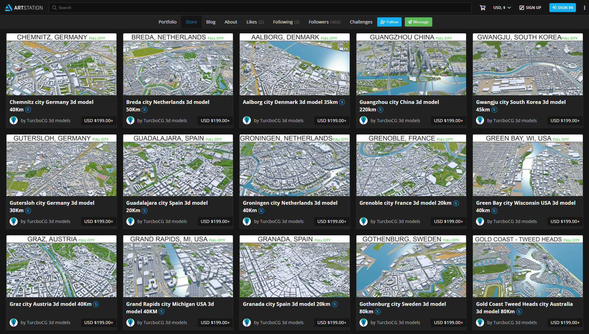
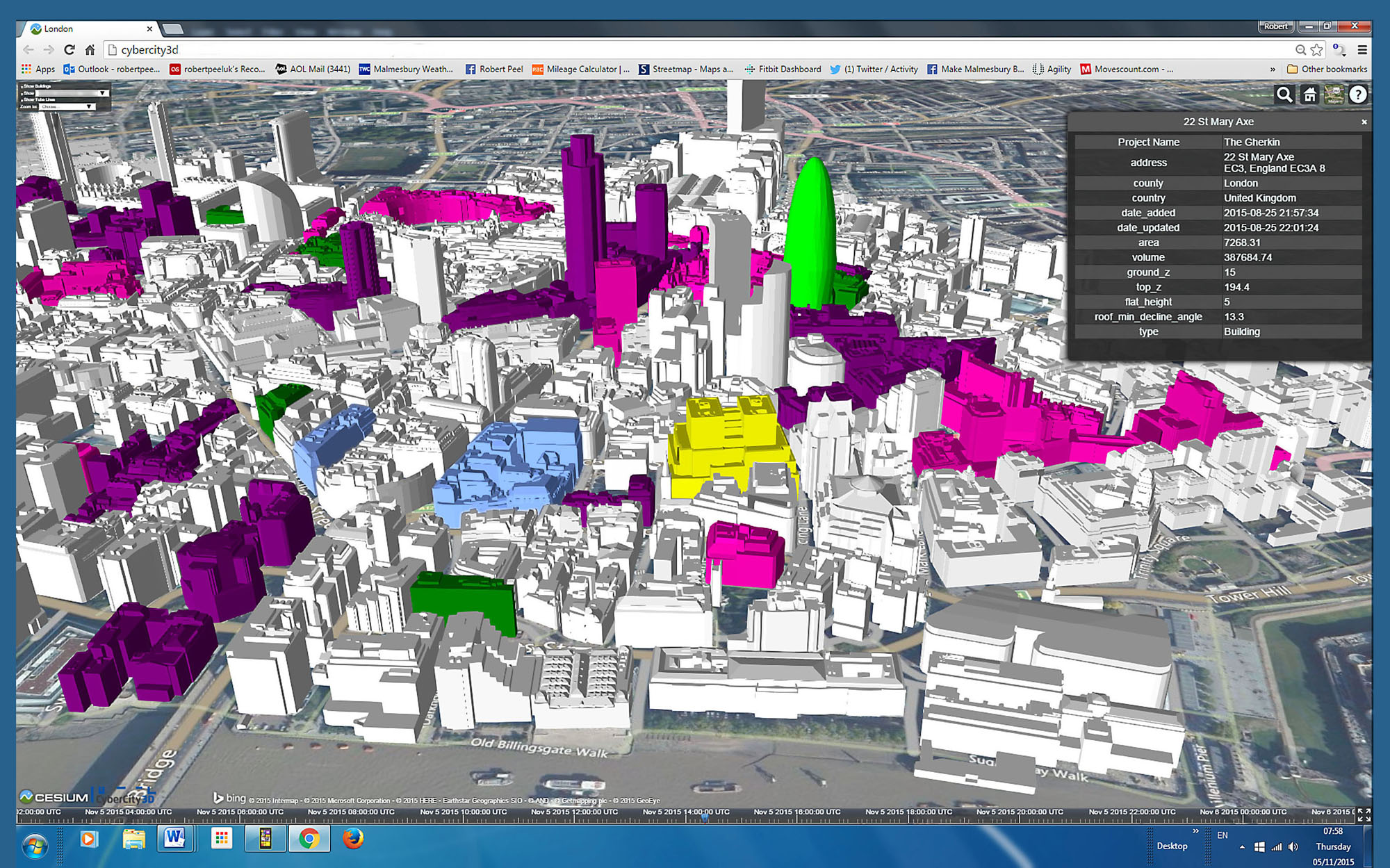
At the other end of the spectrum, there are detailed 3D models of many regions and cities — including their individual buildings and infrastructure — that are manually created by private companies for sale, such as those shown in Figure 3.
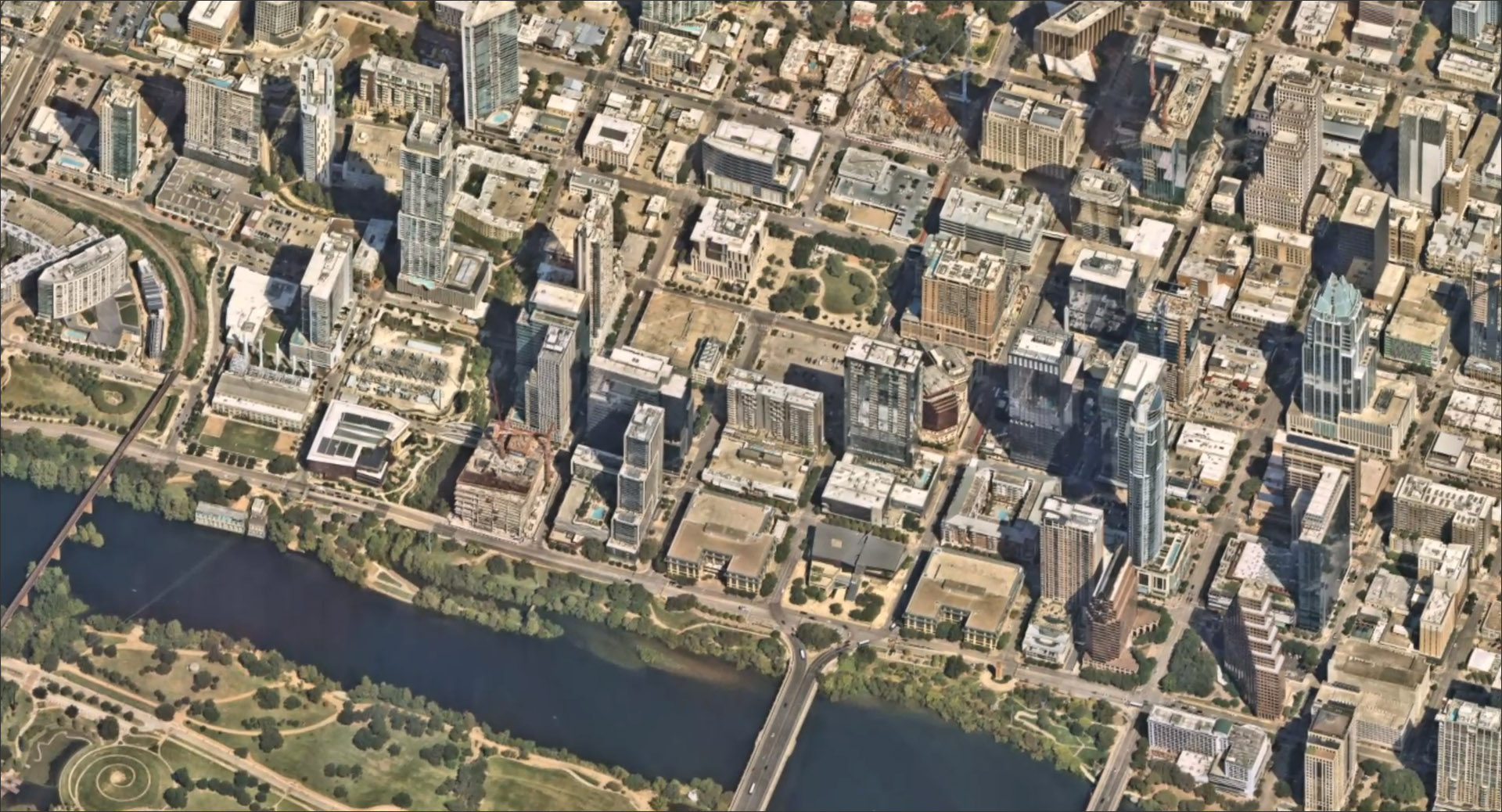
Between these two extremes — entirely automatic and entirely manual — lies another approach, which is to create aerial imagery of a region. This is done by capturing multiple high-resolution photographs of the region from an aircraft, stitching them together, triangulating the 3D positions of the objects within them to create a surface mesh, and then applying the captured images to the individual surfaces. The result is photorealistic aerial imagery that is also 3D, so it can be rotated and viewed from any angle (Figure 4). While it is not as precise as a manually created model, it is available for many more parts of the world and is visually much richer than the automatically created model that was shown in Figure 2.
It is in this domain — creating photorealistic aerial imagery — that Nearmap operates.
Nearmap was founded in 2007 in Perth and is now a public company in Australia. It started with taking aerial captures from aircraft in Australia and subsequently expanded its operations to the US as well as New Zealand. It now covers between 70-90% of the population in these countries, including all of their major urban areas. It has also started operating in Canada and has close to 60% of coverage there.
Prior to Nearmap, capturing aerial imagery was complicated and expensive as it required a surveying company to be commissioned to take aerial photographs of an area and manually stitch them to create aerial maps. The entire process could take months, so it was not likely to be repeated frequently — only once every few years at best (Source: Wikipedia). In contrast, Nearmap’s technology — which includes its cameras and software — allow the high-resolution photos it takes to be stitched automatically, making the aerial imagery available within days rather than months.
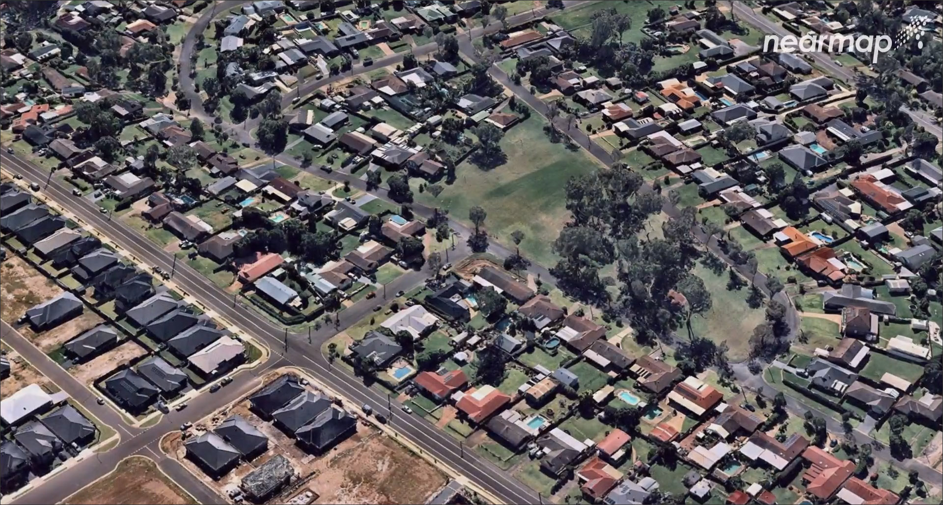
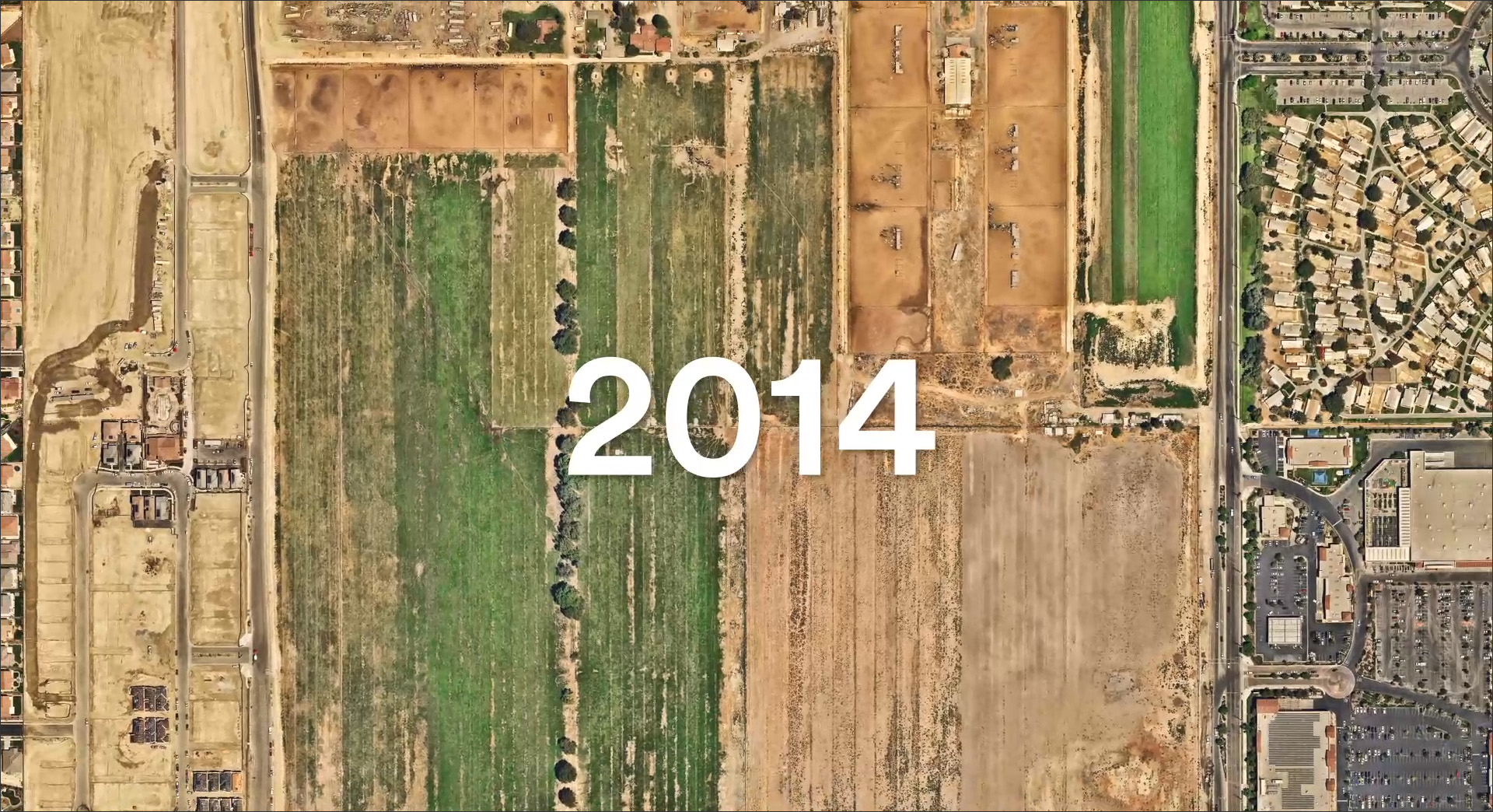
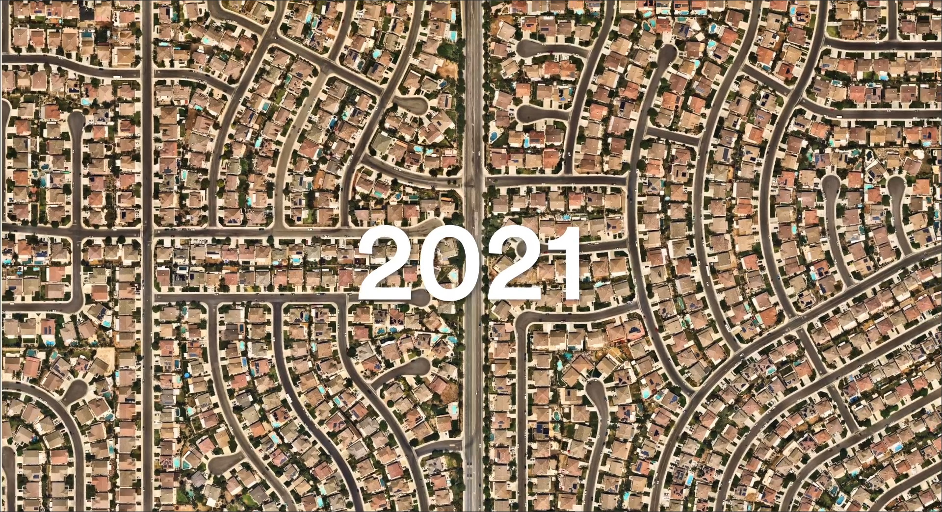
In addition to the speed and accuracy of the aerial imagery, what also differentiates Nearmap is the frequency of its captures, which are done 3 to 4 times a year to update its aerial imagery. Thus, not only does it provide more up-to-date information, the time-stamped aerial imagery can also be used to compare and contrast the development of a region over time, as shown in Figure 5.
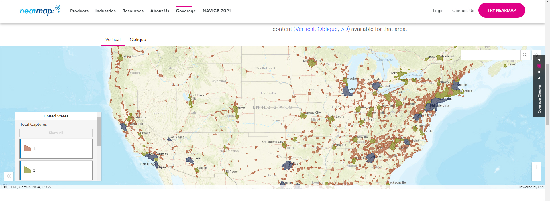
Nearmap’s imagery is useful to any organization or business that needs accurate 3D information for its operations. In addition to building design, infrastructure design, and urban planning — all of which come under the umbrella of AEC — other industries that can use aerial imagery include telecom, utilities, solar, transportation, insurance, etc. All of these are potential Nearmap customers. Nearmap’s content is available through a subscription model, and it provides an interactive coverage map which can be used to find out if a specific location of interest is currently being covered (Figure 6).
Nearmap’s technology comprises both hardware and software components. The hardware includes the camera systems that are doing the captures from the air. Rather than off-the-shelf cameras, Nearmap develops its own proprietary camera systems — these are called Hypercameras, and they continue to be developed to be able to capture a larger number of images at higher resolution with greater efficiency and more detail. The current generation provides a 5.5CM resolution, which is significantly better than the resolution of 30CM that is typically provided by satellites. The Hypercameras are also evolving to be multi-view — able to capture oblique views in addition to looking straight down, as well as 3D imagery which provides more information about the objects being captured.
The software component of Nearmap technology is what converts the content that is captured by its cameras into photorealistic, data-rich imagery that can be used by customers. It includes the software that is used to stitch the images together, which is used internally and is constantly being updated to improve the speed and the accuracy of the imagery processing. The content is streamed to the cloud as soon as it is processed, and it is consumed by the user in two ways: directly through the Nearmap Mapbrowser — which is Nearmap’s flagship application — or through integrations with GIS and CAD/BIM applications from leading companies like ESRI, Autodesk, and Bentley, as well as other third-party or custom applications.
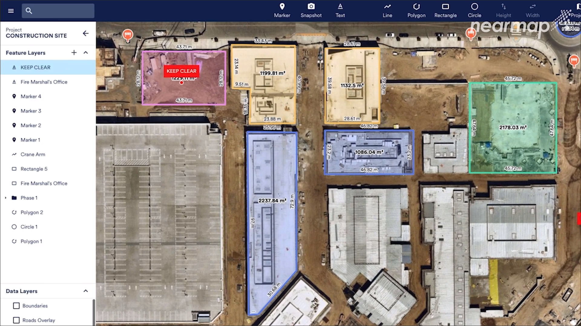
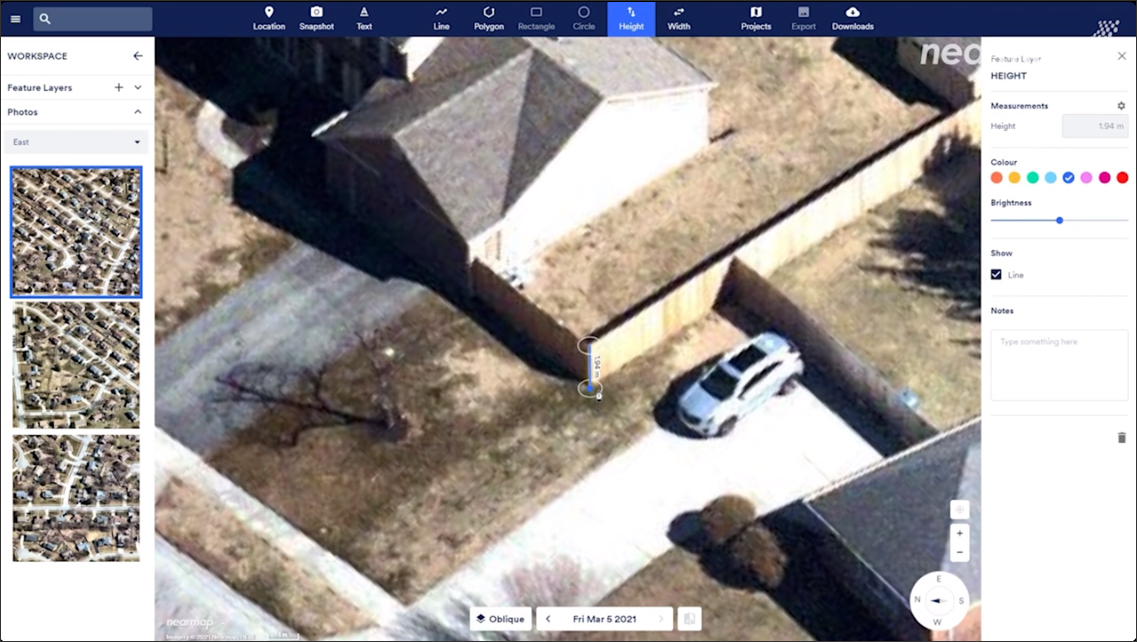
The Mapbrowser is the most common way to access Nearmap imagery and data (Figure 7). It is constantly being updated and offers on-demand access to the latest content. In addition to viewing the imagery, it includes the ability to add annotations and measurements to it, place markers, organize the data in different layers, create and manage projects, and take snapshots to send to other team members for collaboration.
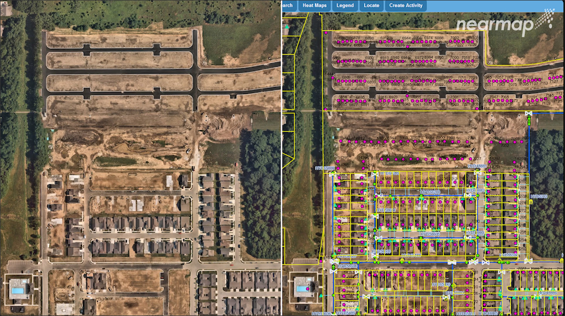
The other way of consuming Nearmap content is through integrations. Nearmap provides a rich set of APIs for the power geospatial users of products from vendors like ESRI, Bentley, and Autodesk — these are typically users who are doing very sophisticated GIS analysis and infrastructure design (Figure 8). They can pull Nearmap content into these products. The APIs can also be used to pull Nearmap content into other applications for different use cases such as appraisal systems, insurance systems, ERP systems, asset management systems, etc., as shown in Figure 9.
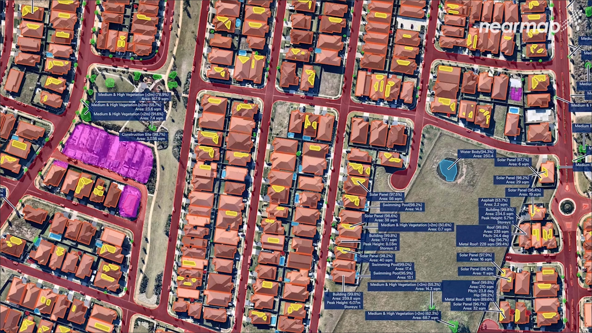
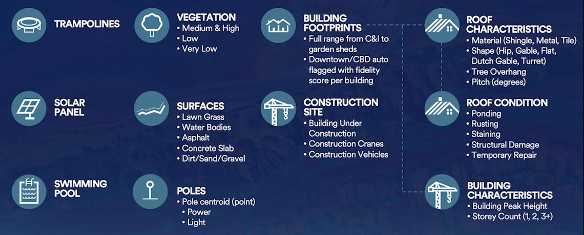
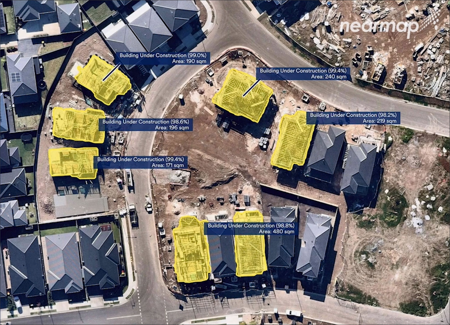
For the past couple of years, Nearmap has been working on using AI (Artificial Intelligence) technology to make sense of the captured data by automatically identifying specific features in the imagery. (For more on AI in AEC, see the article https://www.aecbytes.com/feature/2019/AIinAEC-Intro.html.) These features are available in the form of “AI Packs” for different features such as roads, houses, roofs, vegetation, construction sites, and so on (Figure 10). There are currently 11 of these AI Packs (Figure 11), and more are under development. This AI-extracted information is available in the Mapbrowser as well as through the API integrations, allowing customers in different industries to easily access the data that is relevant to them (Fig 12).
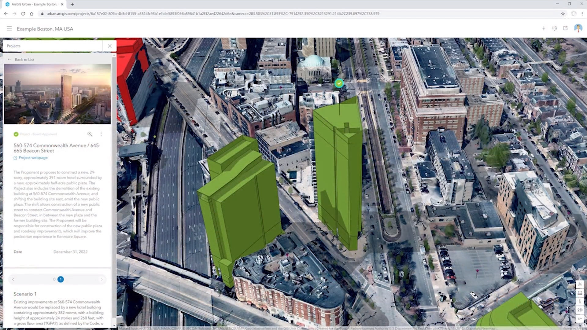
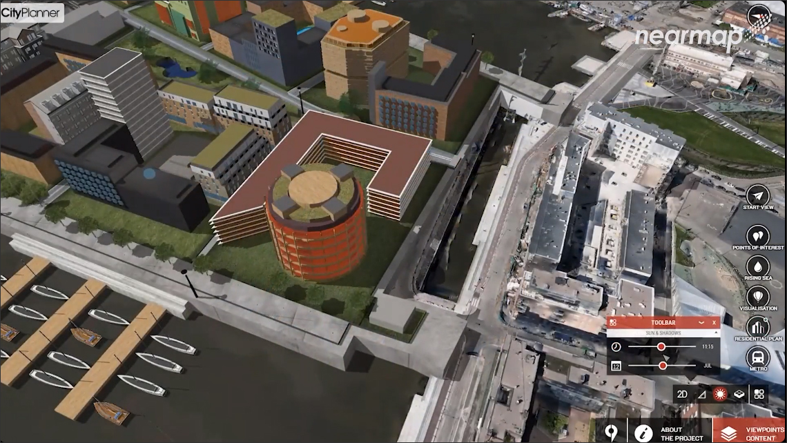
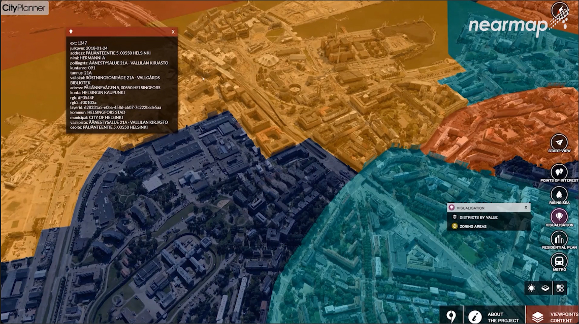
I had the opportunity to learn more about Nearmap by attending its recent NAVIG8 event which included product updates, sessions from partners on how they are integrating with Nearmap, and presentations from customers on how they are using Nearmap. A session by Bentley showed how its CityPlanner application was being used with Nearmap imagery in conjunction with urban planning data to study how a proposed new development would fit into a region, perform lighting analysis, overlay zoning information, and so on, to better help with decision making regarding the development (Figure 13).
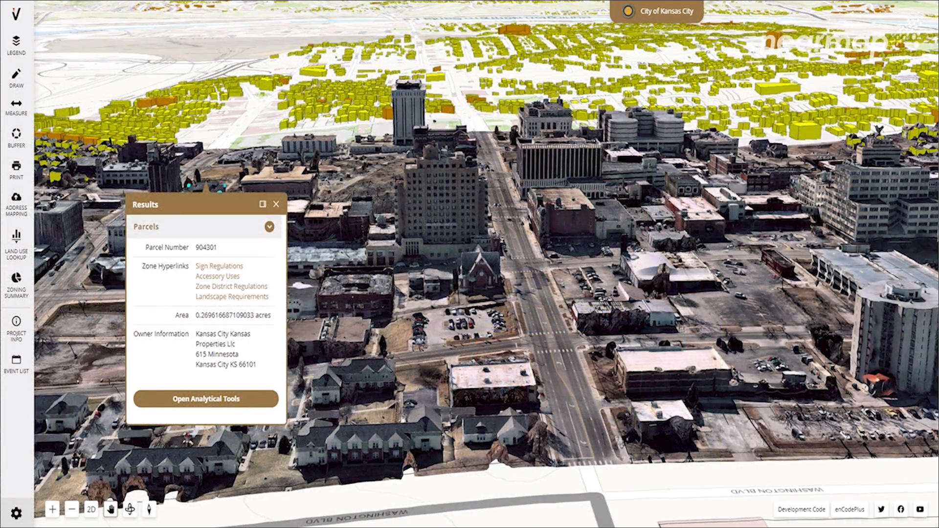
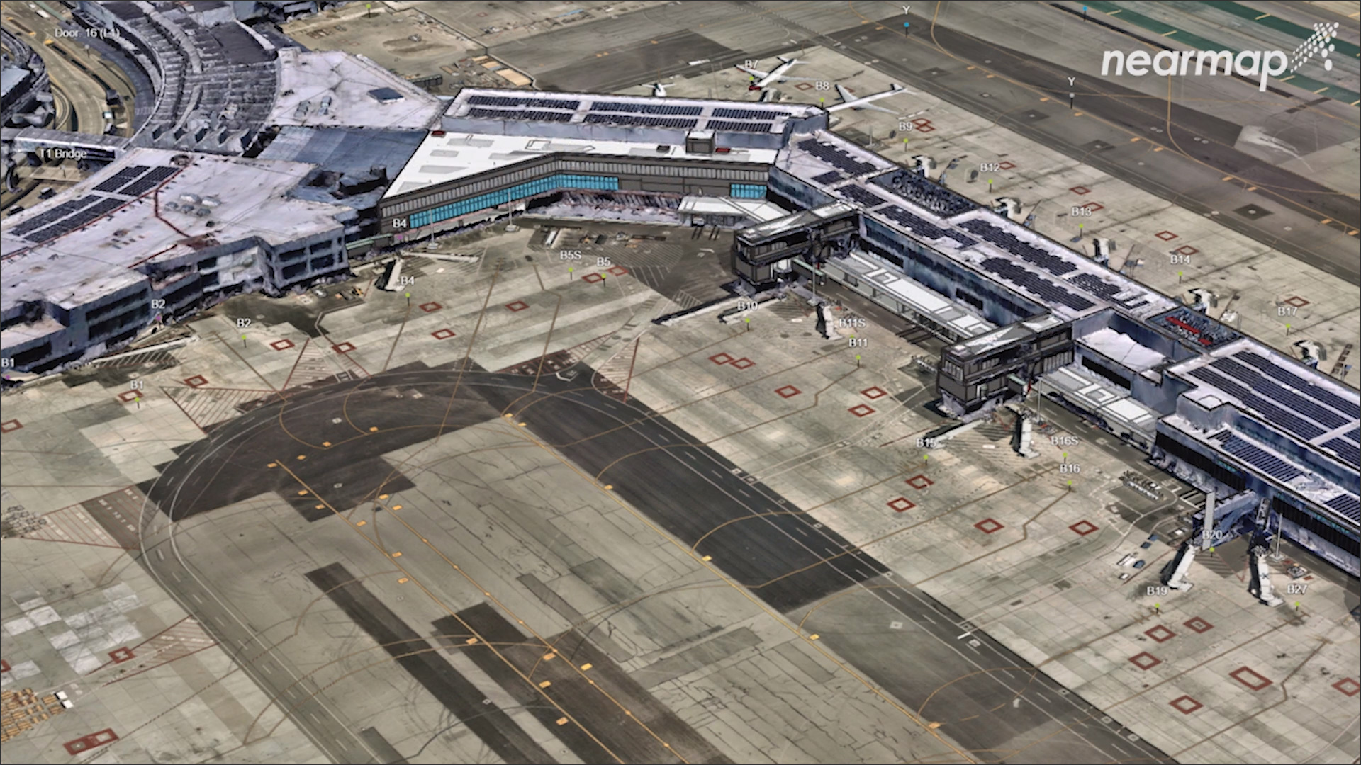
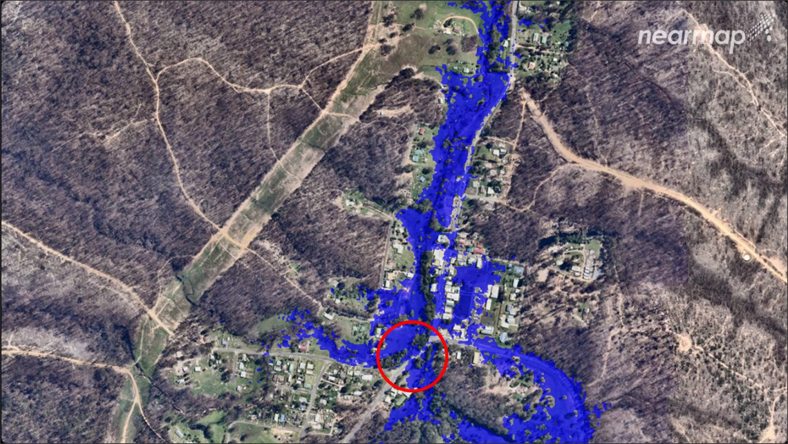
Among the customer presentations at NAVIG8 were the GIS team at SFO (San Francisco International Airport), which showed how Nearmap imagery was being used to better manage the vast infrastructure assets at one of the busiest airports in the world (Figure 14); the City of Carmel, Indiana, which is using an application called Cityworks integrated with Nearmap for various city administrative functions such as utility asset management, searching for permits issued, and checking for code violations (Figure 15); and the use of Nearmap for disaster mitigation by the organization, Disaster Relief Australia (Figure 16).
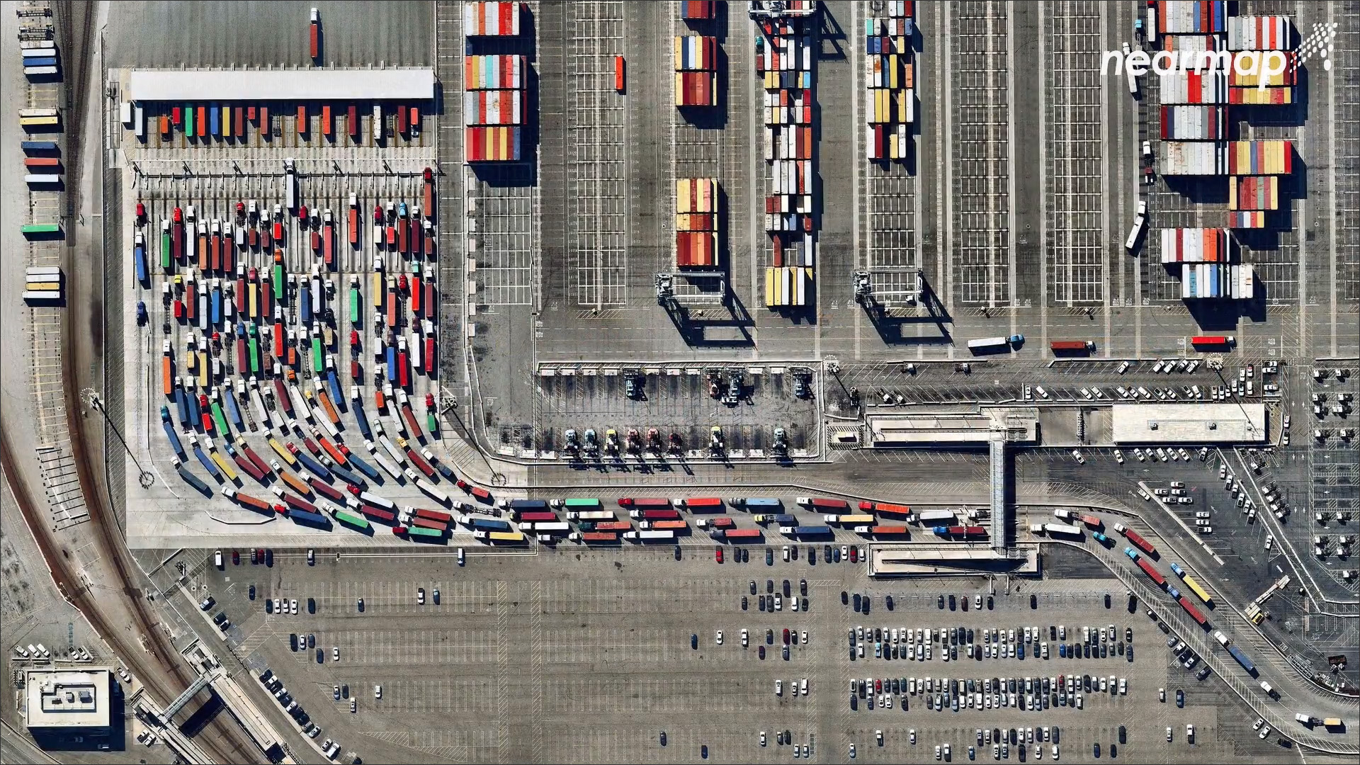
One session at the NAVIG8 event that I found especially fascinating was by Benjamin Grant, founder of a company called Overview, which takes Nearmap imagery and uses it to create a daily overview image of some part of the globe, a new one every day. While the main objective is to highlight the impact humans are having on the planet, many of the images are spectacular in their own right such as the one in Figure 17, which shows long-haul trucks waiting in line to exit the Port of Los Angeles.
It was especially interesting for me to learn more about mapping and GIS because it is the foundation for all building and infrastructure design — every single thing that is physically built is situated in some location on earth. Using a technology like Nearmap to get a more accurate picture of this location can enable buildings and infrastructure to be designed to fit in better with their context, and its new AI-enabled automatic feature detection capabilities can save hours of tedious, manual labor in making sense of the imagery. These are exactly the kind of smarts we expect our technology to have, and it should improve going forward.
Looking at all the Nearmap imagery in the course of researching this article reminded me of how spectacular the earth looks from above when you are flying in an airplane and looking down on it. Of course, there are practical uses to Nearmap, but it’s also nice to be reminded of the beauty of the planet we inhabit.
Lachmi Khemlani is founder and editor of AECbytes. She has a Ph.D. in Architecture from UC Berkeley, specializing in intelligent building modeling, and consults and writes on AEC technology.
Have comments or feedback on this article? Visit its AECbytes blog posting to share them with other readers or see what others have to say.
AECbytes content should not be reproduced on any other website, blog, print publication, or newsletter without permission.
This article captures the developments in the software available for BIM for infrastructure, including solutions from Site3D, CGS Labs and SierraSoft, Allplan Civil Engineering and Allplan Bridge, Autodesk Civil 3D and InfraWorks, and the many solutions from Bentley.
Exploring the solutions for “city information modeling” from BIM stalwarts such as Autodesk and Bentley to CIM-specific companies such as virtualcitySYSTEMS, Cityzenith, SmarterBetterCities, CyberCity 3D, and Agency9. Also, how is CIM different from the concept of “Smart Cities?”.
This review explores ICL, a new technology platform for developing sustainable communities that includes tools for modeling, monitoring, and analysis. They can be used independently or integrated into a digital twin for sustainable design.

The use of AI (artificial intelligence) in AEC applications is starting to see some traction. This article provides an overview of the technology underlying AI so we have a better understanding of it and then compiles what we have so far in terms of the use of AI in AEC.