


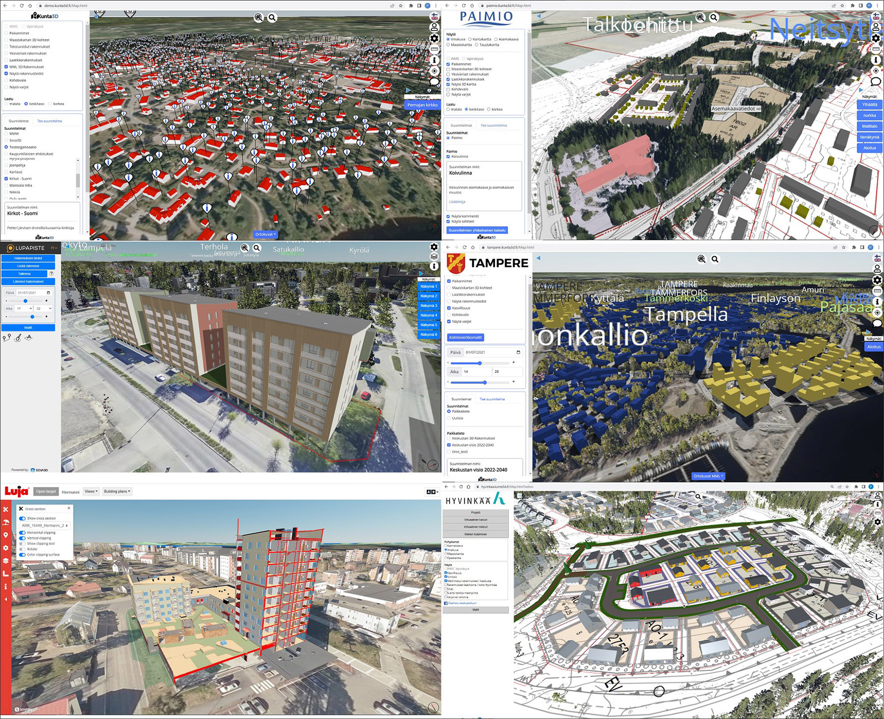
In the article, “What Happened to CIM?” that was published a few months ago, I highlighted some of the current work being done in CIM (City Information Modeling) that I was aware of, including pilot projects in Lancaster, UK, and in Nanjing, China. Given how critical a CIM platform is for the development of smart cities and urban digital twins, I was delighted to hear of a CIM platform that has not only been in commercial development for several years but is also being actively implemented in several cities to support their planning and management activities. This is the Sova3D CIM platform developed by Sova3D Oy, a Finnish company, and it is being implemented by several municipalities in Finland using the moniker, Kunta3D, as shown in Figure 1. (The word “kunta” means municipality in Finnish.)
This article provides an overview of the Sova3D CIM platform and one of its implementations in a Finnish municipality. It also explores how Sova3D enables online building permitting, which is one of its key use cases.
Sova3D Oy was established in 2015, co-founded by Petri Kokko who has been working in the AEC technology field since the 1990s and brings his extensive experience of developing CAD and BIM solutions to CIM and urban digital twins. The company is registered in Finland, which is one of the most technologically advanced countries in the world. (See more about the technology industry in Finland at https://teknologiateollisuus.fi/en/technology-finland.) In addition to global brands like Nokia, Finland is also home to leading AEC technology companies such as Solibri (now part of Nemetschek) and Tekla (now part of Trimble). This makes the development as well as the implementation of a CIM platform like Sova3D in Finland fully in line with the country’s pioneering approach to technology.
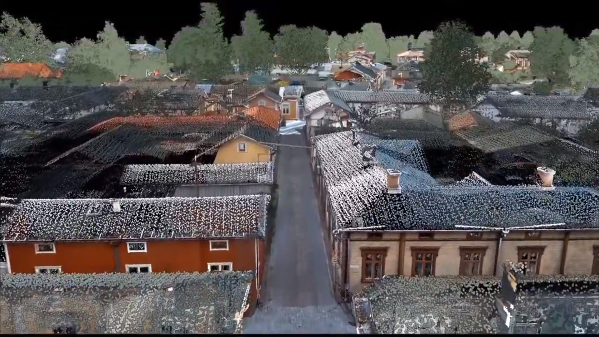
One of the key investors in Sova3D is another Finnish company, Terrasolid, which develops a suite of software tools for mapping, terrain modeling, and point cloud processing for several industries, one of which is 3D city modeling. It can create highly accurate and textured 3D building and terrain models automatically from laser scanning data and oblique images (Figure 2), making Sova3D a good fit for its technology.
Another key partnership for Sova3D is with a company called Cloudpermit that develops software for streamlining the application and approval of building permits. Cloudpermit is also a Finnish company, established in 2011, and it has subsequently expanded to the US and Canada with implementations in cities in New York, Pennsylvania, Wisconsin, Georgia, Colorado, Ontario, and Manitoba. In Finland’s Sova3D CIM implementation, building permit processing is one of the key functionalities of the platform, and it has been created by direct integration with Cloudpermit.
The Sova3D platform is a web-based service for publishing 3D city models which can then be viewed and navigated in a web browser. The models are created by combining the data from a wide variety of available sources including any Terrasolid captures (such as the example shown in Figure 2), CityGML, 3DTiles (mesh models), OpenBIM (IFC), LandXML, national as well as regional survey data, and any other GIS and mapping data. BIM models of buildings in the IFC format can also be brought in, both at the building-permit application stage as well as after a building has been approved and built. This allows a city model to get very detailed over time as more building models are added to it.
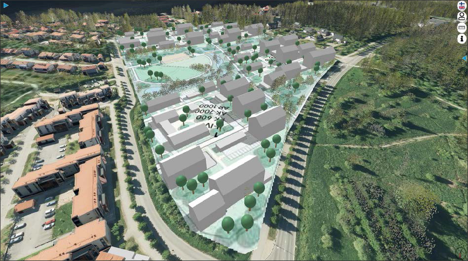
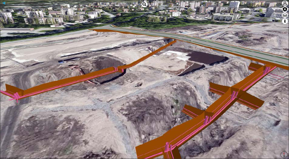
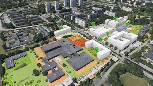
Once the base city model is in place, city planners can upload their upcoming design plans to the platform so they can be reviewed in the context of the surrounding neighborhoods and better understood by other city departments, stakeholders, and the city’s residents (Figure 3). The platform includes a commenting capability that can be used to capture evaluation and feedback on the proposals. Similarly, models of any planned utilities and infrastructure can also be uploaded, if required, so that they can be evaluated in the context of the existing city environment.
It should be noted that the Sova3D model is currently a static CIM (city information model), but it can become the base for a live digital twin of the city by linking it to the physical elements of the city with sensors placed at strategic locations. This digital twin could then be used to operate and manage the city, allow real-time what-if analysis of different scenarios, and enable different “smart city” capabilities to make cities better planned, more connected, and more livable.
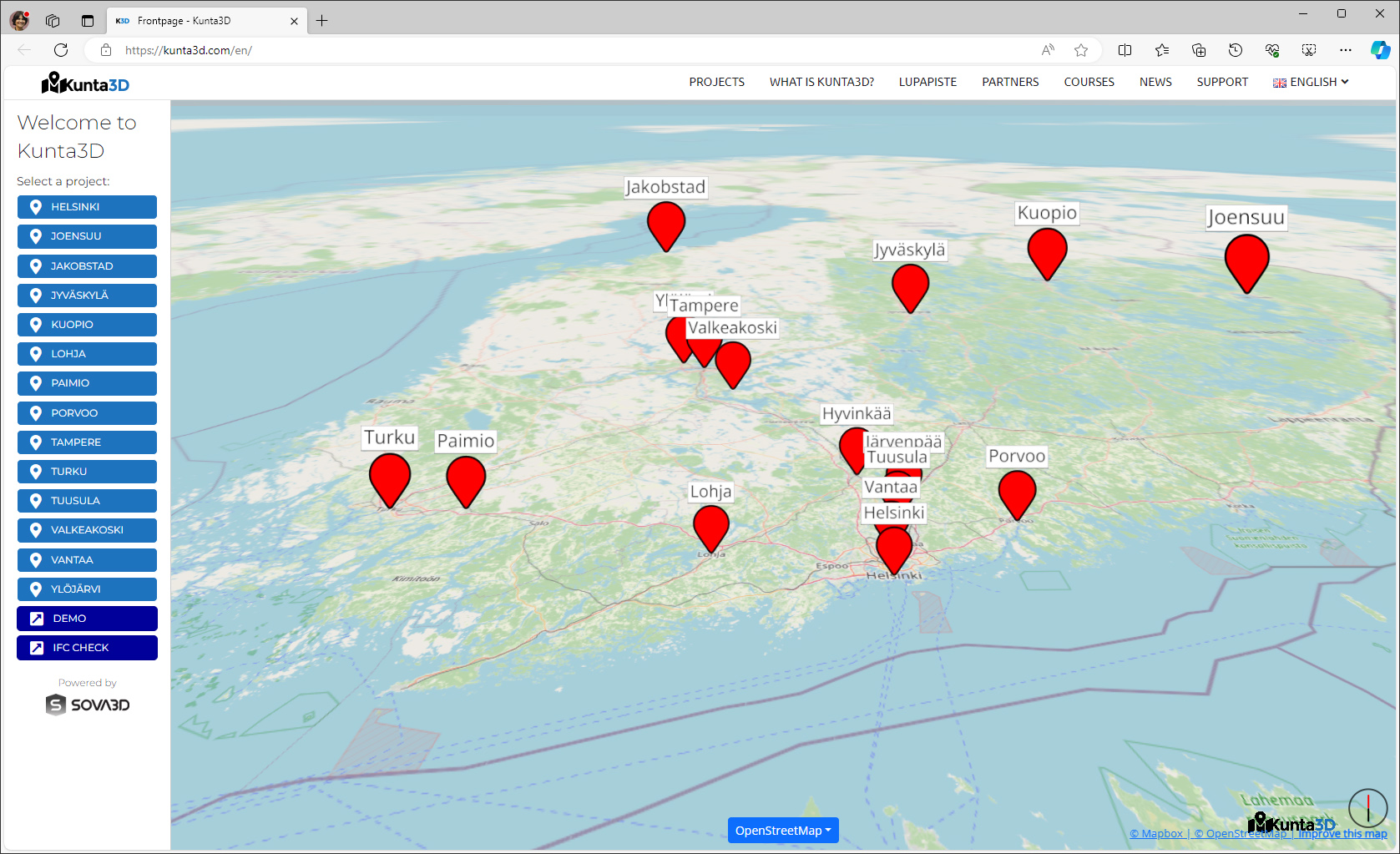
As mentioned earlier, the Sova3D CIM platform is being implemented by several municipalities in Finland using the name, Kunta3D. The main web page of the service provides a link to all the municipalities using it, as shown in Figure 4. For each municipality, the service is branded by its name, as was shown earlier in Figure 1.
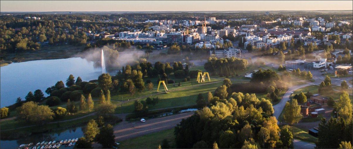
One of the cities that is implementing the Sova3D platform is Järvenpää, which is a small city of 50,000 inhabitants located about 35 kilometers north from the capital city of Helsinki. Figure 5 shows a photograph of the actual city at the top, followed by its Kunta3D implementation.
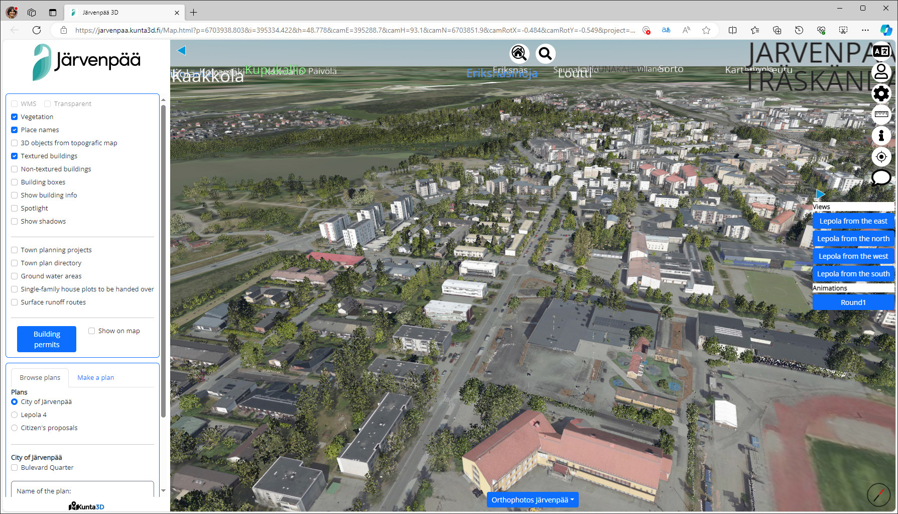
I found the Kunta3D interface very intuitive to use with tabs on the left side to turn the visibility of different components of the model on and off, the ability to save different views for easy access, and tools for measuring, commenting, and search. When the CIM page is first opened, the city model takes a few minutes to load, but subsequently, navigating the model was very quick, even though it was being streamed through a web browser. The level of detail of the model is LOD2, which comes from the CityGML standard. (For more on LODs for city models, see https://3d.bk.tudelft.nl/lod/.)
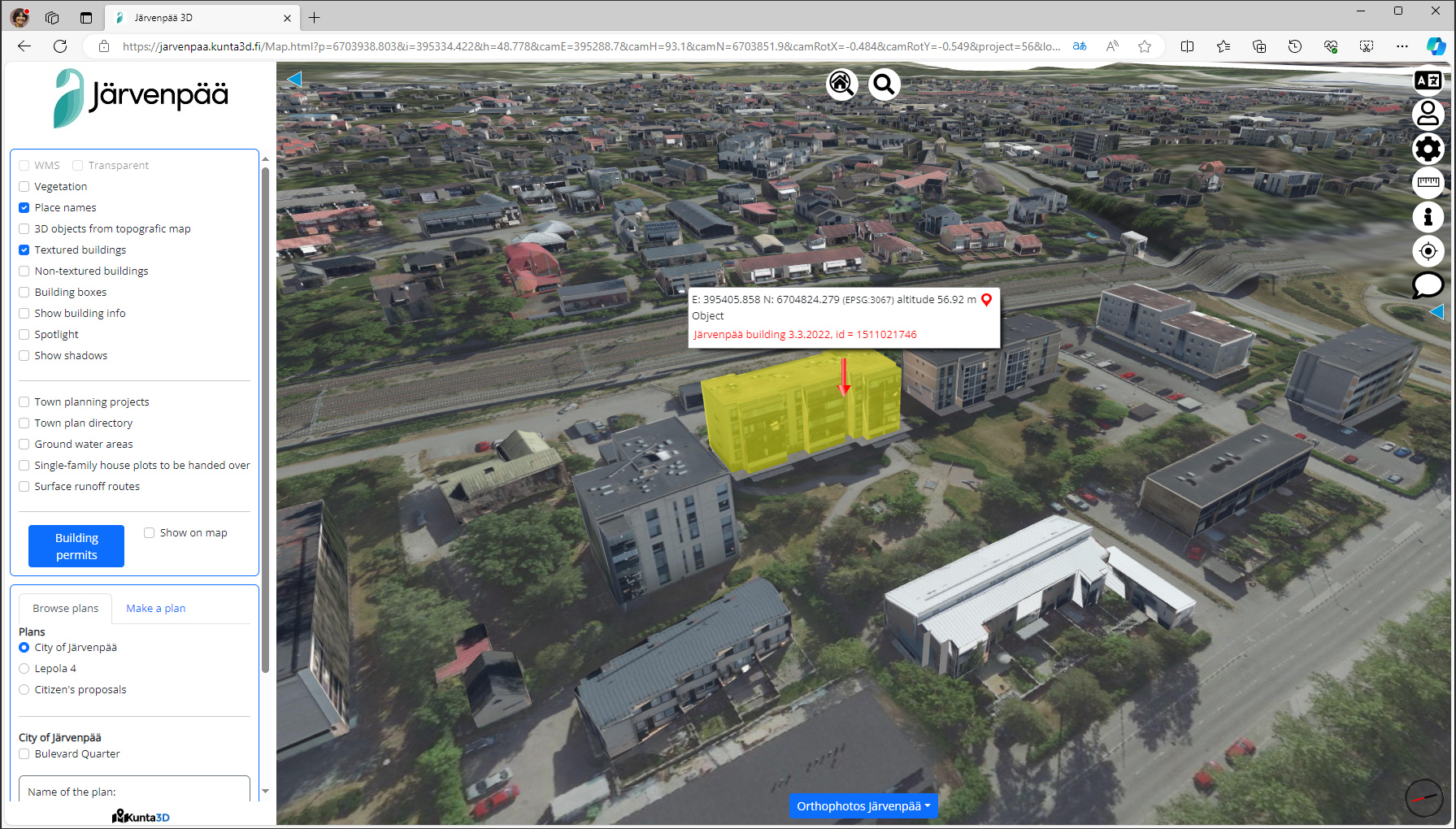
You can click on any of the buildings to select it as shown in Figure 6, showing that all the buildings are brought in as separate entities. The initial building models are created from surveying data and Terrasolid captures rather than from BIM. In time, as more BIM models are brought in for building permits, these will become part of the city model. (This is done by first exporting the building model from the BIM application to the IFC format, and then converting the IFC file to the CityGML format for input to the Sova3D platform.)
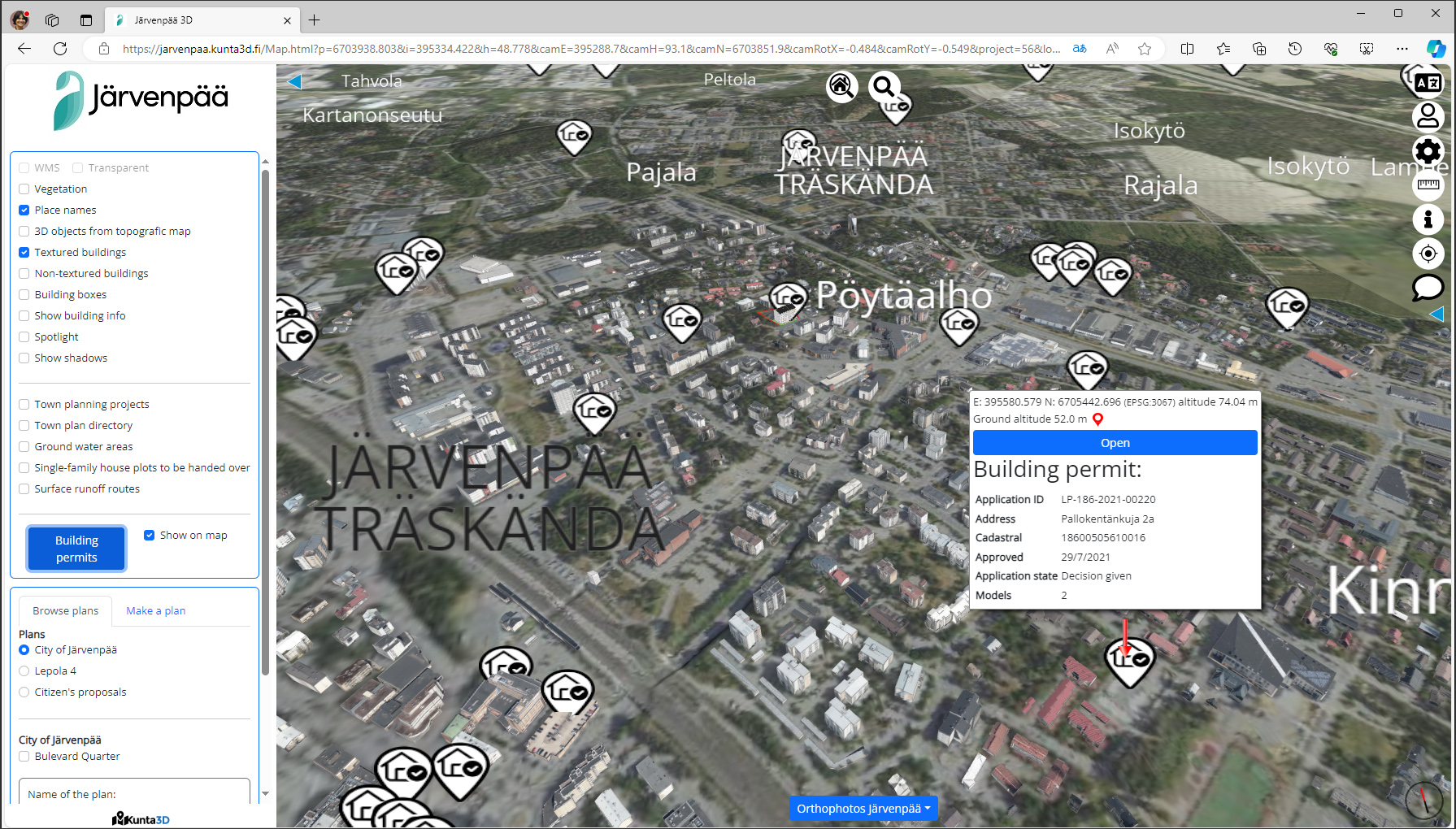
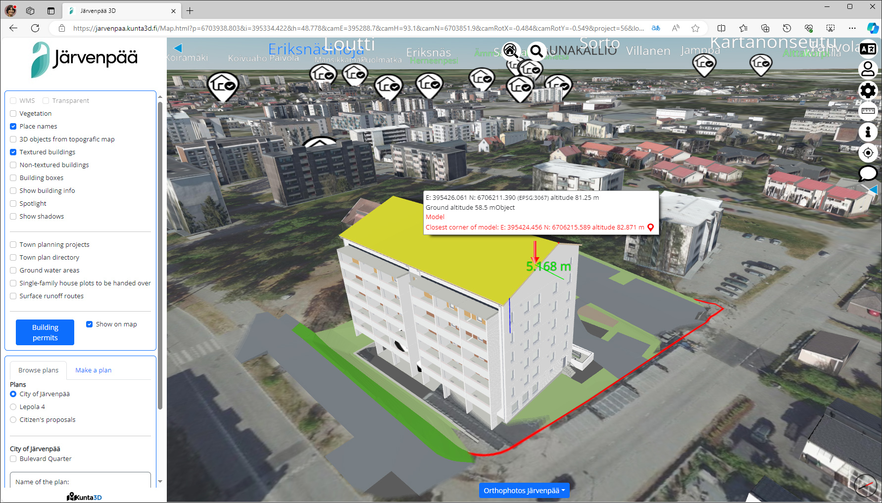
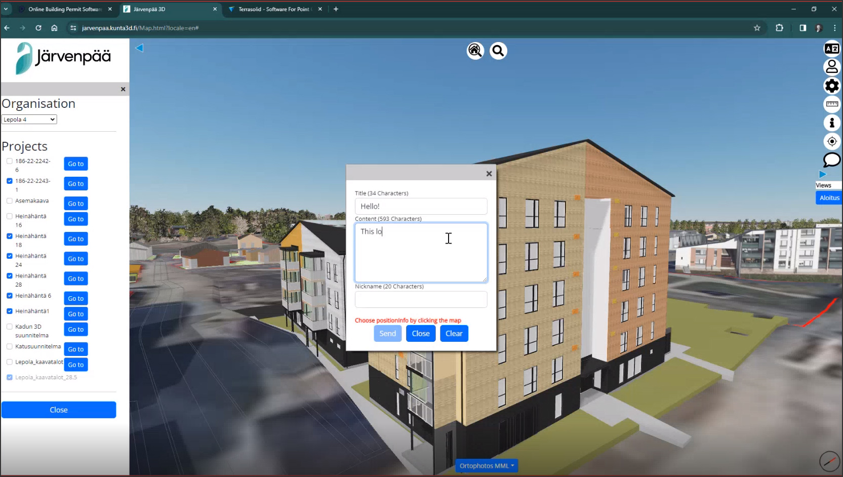
One of the key functionalities of the Sova3D platform is to facilitate the application and approval of building permits, a functionality that has been enthusiastically adopted by the city of Järvenpää as part of its implementation. All the open building permits that are being processed for the city can be seen by checking the box next to the “Building permits” option, as shown in Figure 7. Clicking on any of the permit bubbles shows more information about the permit, and if you click the Open button in the Info box, you are taken to the area of the model where the building for which the permit is being applied is located. This building does not yet exist, so its model is not coming from any mapping or capture data, but from a BIM model (converted to CityGML via IFC as mentioned earlier). Thus, you can now click on individual elements of the building, as shown in Figure 7; the entire building is not a single model, as was shown in Figure 6. (It should also be noted that starting from 2025, it will be mandatory in Finland to submit an IFC model for a building permit application.)
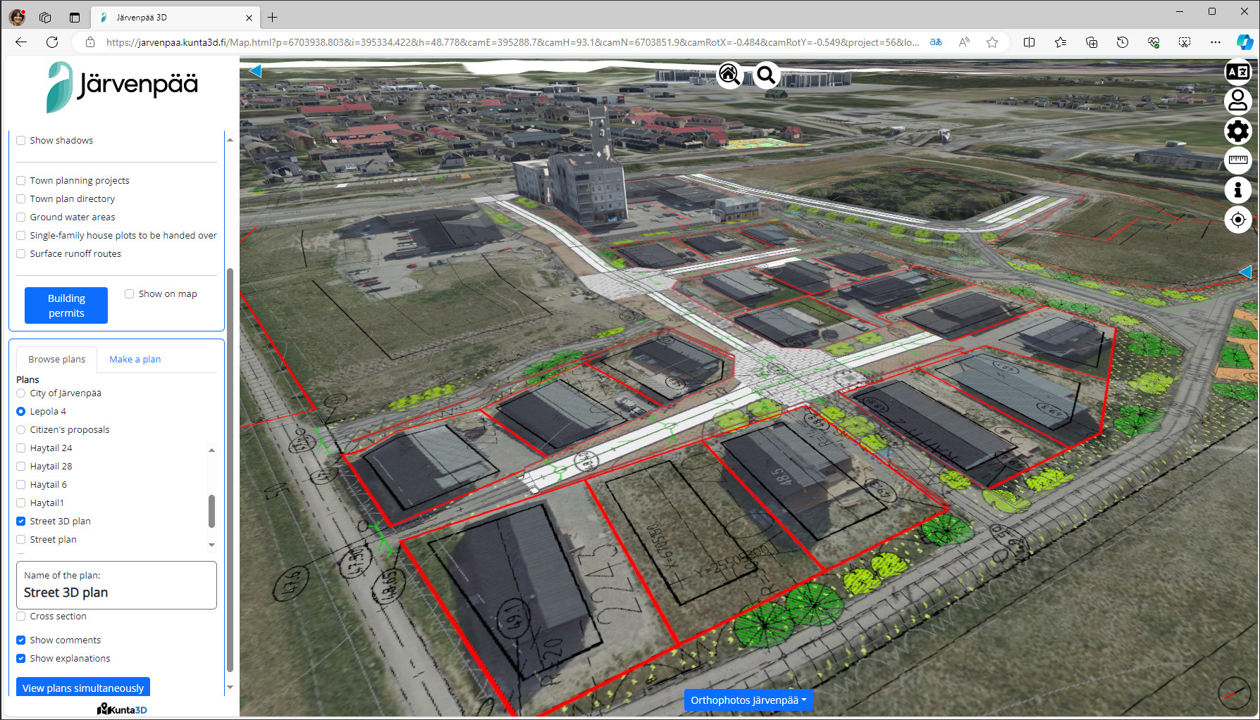
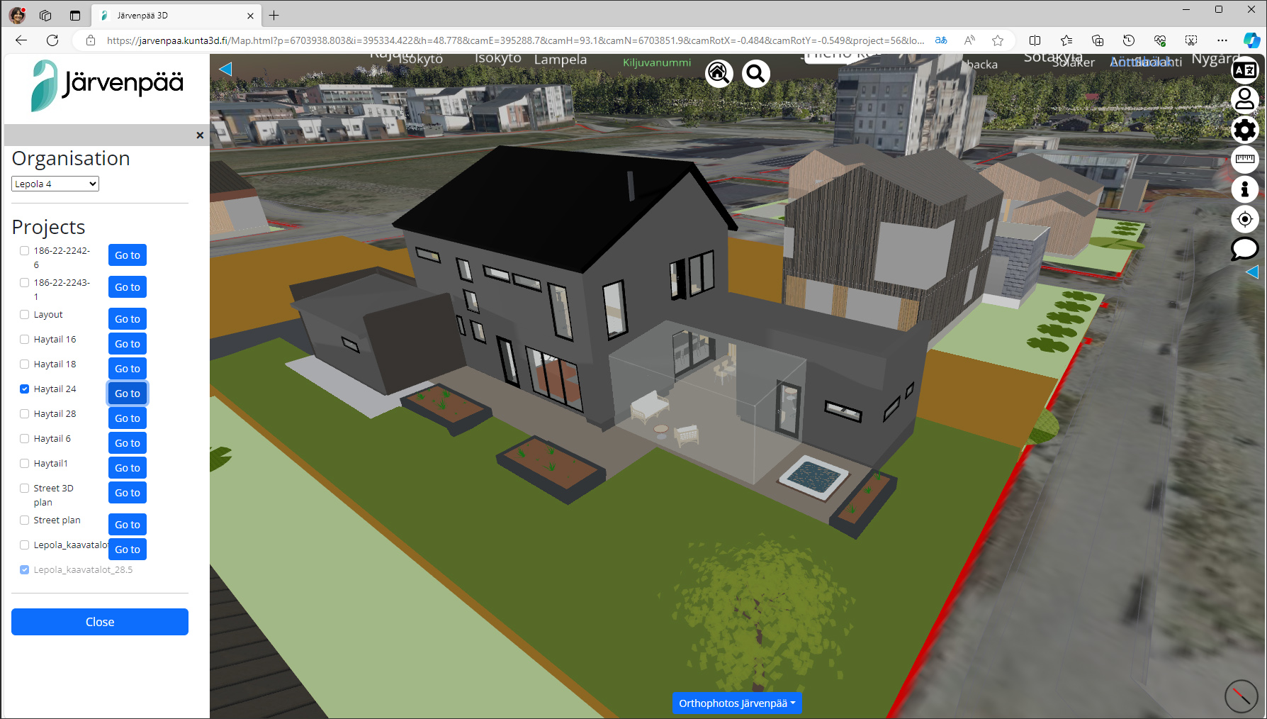
Additional capabilities of the platform include the ability to browse through the different urban design scenarios as well as specific projects that are being planned (Figure 8); a commenting capability that can be used to collect feedback from residents on design proposals for consideration by the city authorities (Figure 9); and a chat feature that allows specific views to be shared with other team members or stakeholders so that they can explore the same city model from the exact same location.
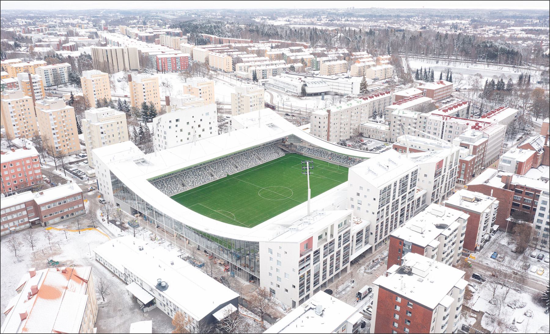
In order to explore the building permit functionality of Sova3D in more detail, a good case study is the “Tammela Stadion” project, a new football stadium in the city of Tampere on which construction has just been completed (Figure 10).
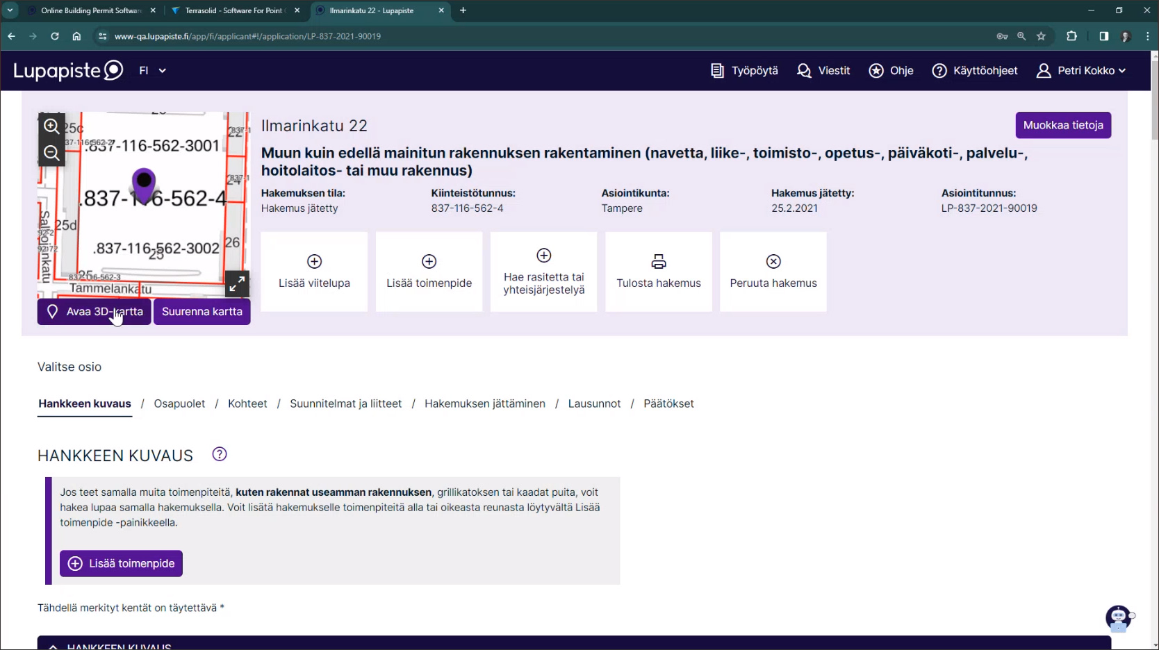
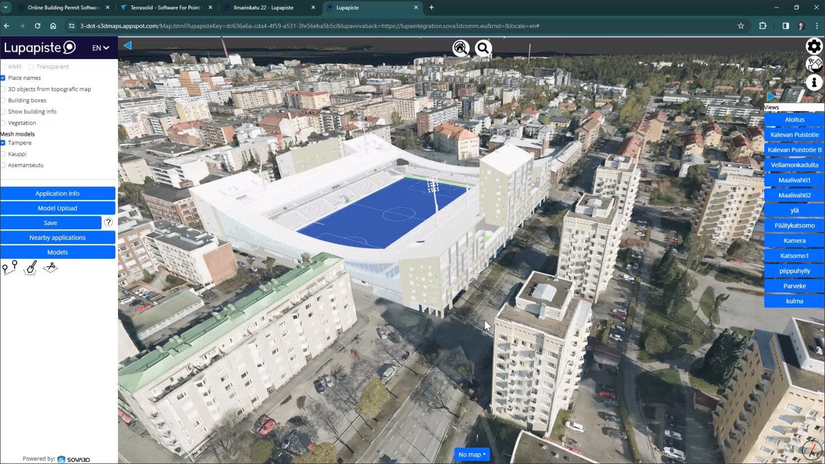
The permitting process for this project was started three years ago, using the integration of Cloudpermit’s technology — known in Finland as “Lupapiste,” which translates to “Permit point” in English — with the Sova3D CIM platform. Clicking on the 3D model of the project on its Lupapiste page opens it in Sova3D, as shown in Figure 11. The BIM model of the stadium was submitted by the architect as part of the building permit application, and it can be seen in Sova3D in the context of the surrounding neighborhood, allowing city officials, residents, and other stakeholders to understand and evaluate the proposed design.
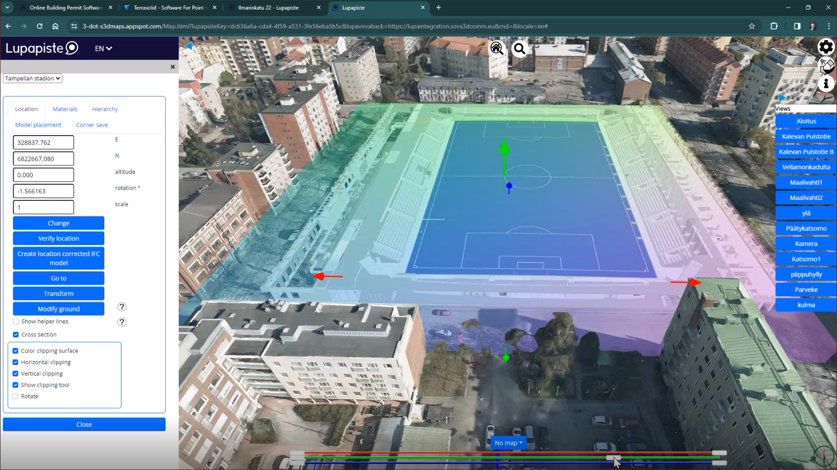
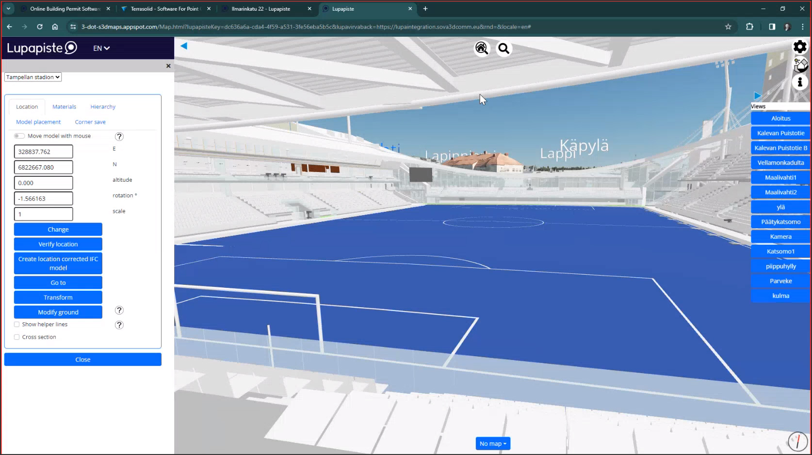
Since the model submitted for the building permit is an IFC file, it includes detailed information about the building, and these details can be seen in the Sova3D platform, as shown in Figure 12. There are also cross-section tools that allow the model to be sliced so that the internal structure can be explored in more detail, as well as preset views saved by the architect that allow the project to be viewed from multiple perspectives (Figure 13).
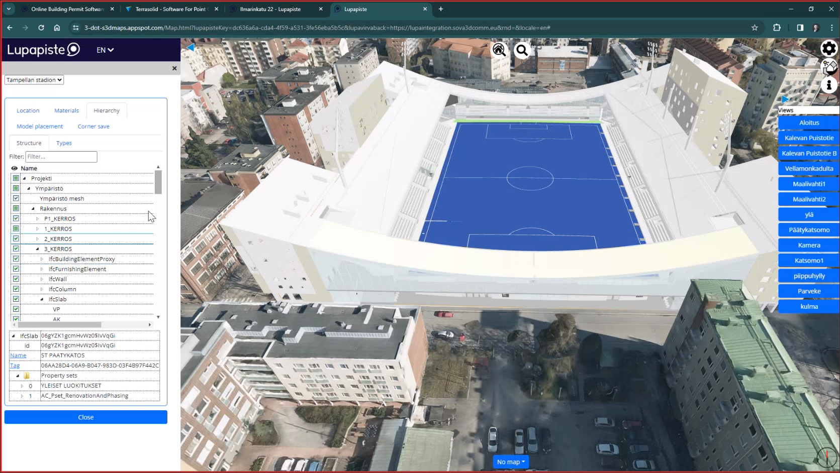
Additional capabilities of the platform for building permit evaluation include the ability to select any building element to see its properties; the availability of filters in order to view only specific categories of elements, for example, load-bearing walls, slabs, columns, etc.; and the ability to evaluate daylighting for the project on different days and times of the year by adjusting its settings.
I am based in Santa Clara, the heart of the technology hub that is Silicon Valley, yet there is nothing here even close to a city model, let alone online building permitting. The concept of having CIM (City Information Modeling) implemented where I live has, until now, seemed like a remote possibility. But seeing the Sova3D CIM platform being embraced and adopted in Finland — not just as a pilot project but as a full-fledged implementation addressing actual problems and facilitating real-world processes like building permits — gives me hope. Sova3D has shown that CIM, and consequently urban digital twins and truly smart cities, may actually be closer to reality than we think.
Lachmi Khemlani is founder and editor of AECbytes. She has a Ph.D. in Architecture from UC Berkeley, specializing in intelligent building modeling, and consults and writes on AEC technology.
Have comments or feedback on this article? Visit its AECbytes blog posting to share them with other readers or see what others have to say.
AECbytes content should not be reproduced on any other website, blog, print publication, or newsletter without permission.
This Viewpoint explores what happened to the concept of “City Information Modeling” (CIM) for city planning and management, which is similar to the concept of “Building Information Modeling” (BIM) for building design and construction. Has CIM been subsumed by the concept of “urban digital twins”?
This article explores the solutions for “city information modeling” from BIM stalwarts such as Autodesk and Bentley to CIM-specific companies such as virtualcitySYSTEMS, Cityzenith, SmarterBetterCities, CyberCity 3D, and Agency9. Also, how is CIM different from the concept of “Smart Cities”?
In the wake of Hurricane Katrina in 2005, this article explores how technology is being used in the relief, rehabilitation, and reconstruction efforts along the Gulf Coast, and what technologies we might need in the future for cities prone to natural disasters to combat them more effectively.

This article describes a promising initiative in the application of digital twin technology at the city level: the DUET project, which is focused on creating digital twins — i.e., virtual replicas — of cities in Europe to allow them to be better designed, operated, and managed.