


Dresdner Robin is an award-winning land-use consultancy with a specialty in urban design and development, plus brownfield redevelopment. At Dresdner Robin, we increase property values for our clients by helping them transform their sites to a higher level of functionality and use. A one-stop shop with 45 years of experience, we provide integrated engineering, planning (including zoning and entitlement), environmental, survey (including GIS and expert measurement) and landscape architecture design services in New York City, New Jersey, and Philadelphia.
As a leading land-use firm for the Tri-State Area, we focus on urban redevelopment, green infrastructure, last-mile (site development), transportation projects, utility/transportation infrastructure, 3D data deliverables and graphical information systems.
Further, utilizing our strong foundation in traditional survey practices like boundary and topographic surveys, we have embraced technological advances in non-contact measurement. As a result, Dresdner Robin is now a leader in this growing market need and we are committed to raising the bar as new technologies develop.
Much of our work also focuses on data visualization, assisting project teams early in the development cycle – allowing key phases of site preparation and construction to commence.
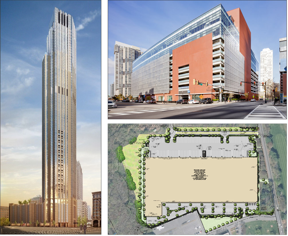
While Dresdner Robin is engaged in numerous projects across the Tri-State Area, here are a few notable projects (Figure 1) we have recently been involved with:
Philadelphia Green Streets Initiative: To decrease sewer overflow and increase the number of sustainable communities in Philadelphia, Pa., the Philadelphia Water Department (PWD) implemented the Green Streets Initiative. Dresdner Robin is partnered with PWD to implement innovative stormwater management techniques and landscape design.
99 Hudson: What was formerly an ordinary commuter parking lot in Jersey City, N.J., has been transformed into a 900-foot skyscraper – the tallest in New Jersey. Dresdner Robin provided advanced technology and survey services, and planning services that amended the area’s redevelopment plan. We also performed preliminary grading design, utility design and stormwater modeling – which culminated in obtaining approval from the city’s Planning Board. Dresdner Robin also prepared final construction documents and secured various permits. Throughout construction, we continued to provide administrative services and oversight for the installation of the utility infrastructure.
Jersey City Whole Foods: Our firm provided expert services on the future home of Jersey City’s first Whole Foods Market. We coordinated all local and state approvals. The market will be constructed within two levels of an existing parking garage, which is part of Mack Cali’s’s Harborside Plaza 4A. Dresdner Robin assisted project architects at HLW International by carrying out a precise measurement of the site and by mapping the facility by using laser-scanning technology.
150 Totowa Road: Dresdner Robin provided land development services for a new warehouse distribution center along Totowa Road in Wayne, N.J. As part of our services, we prepared conceptual site plans which were refined into site construction documents, including site layout, grading, drainage and utility design. A key undertaking during the design process was to prepare a plan that minimized the disruption of existing utilities that traversed the property. Dresdner Robin also successfully obtained regulatory land-use approvals. During construction, we documented construction activities using state-of-the-art drone equipment to create topographic surveys through ortho-photogrammetric survey procedures.
We began using data and AEC technologies in the 1980s and continued to incorporate digital advances during the rapid innovations of the ’90s, 2000s and through today.
Today, we use software/data tools throughout our service platform to collect and evaluate data and design everything from adaptive reuse projects and landscape architecture, to utility connections and remedial plans. It is a collaborative, team effort, but much of our project management utilizes market and custom software tools.
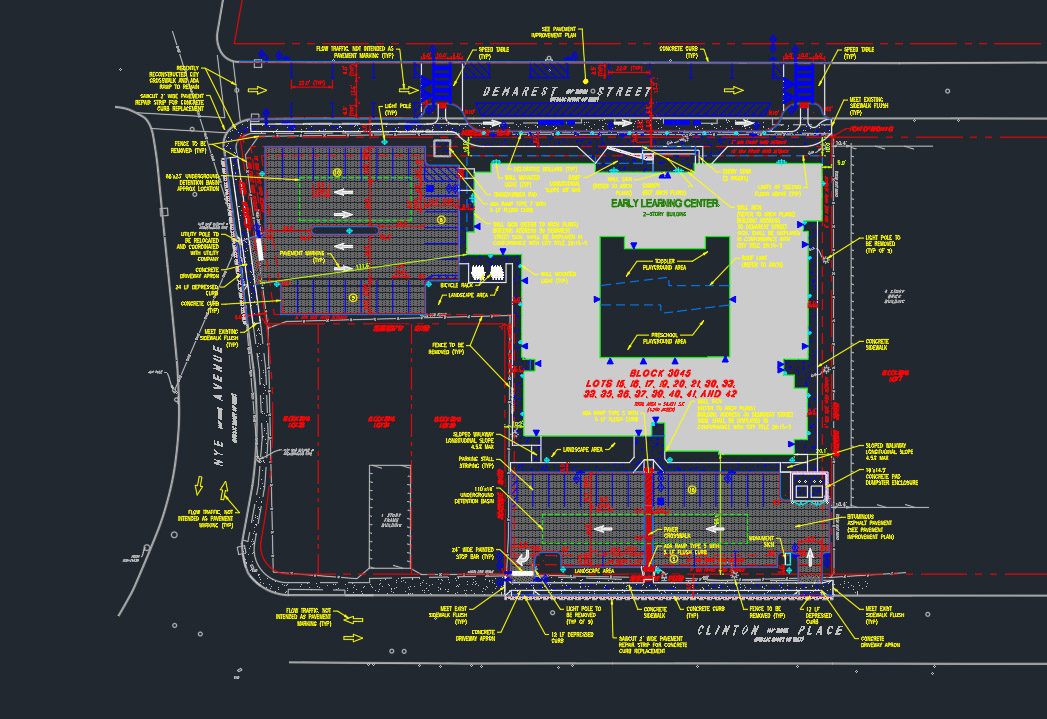
The main application for our design work is AutoCAD Civil 3D, the 3D computer-aided design program that uses key data to visualize sites (Figure 2). We also use Pipe Network Design within the Autodesk suite, a digital tool that allows us to map and design onsite utilities.
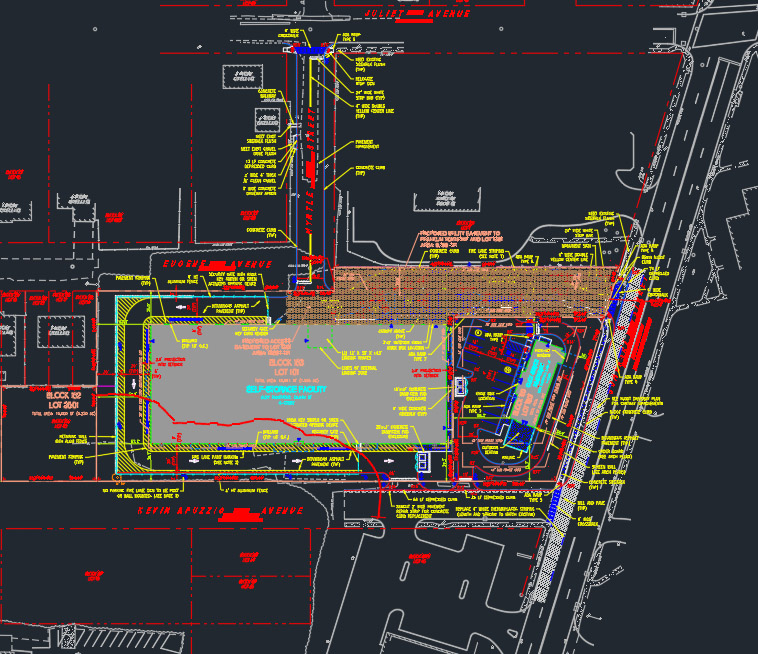
We also currently use SketchUp, the 3D modeling program for massing/zoning analysis (which places models within Google Earth – a useful method to visualize sites), as shown in Figure 3. For project scheduling, Dresdner Robin utilizes Microsoft Project, where PMs keep a detailed schedule, assign tasks and more. For cost estimating, we also rely on RSMeans, a helpful database allowing us to quantify and validate costs. One other helpful AEC technology application is Bluebeam, a tool where we can create, edit, mark-up and share detailed PDFs.
Our firm-wide ERP is Deltek’s Ajera, which incorporates fully integrated business process modules including client and project management, resource management, business development, finance and accounting, employee time and expense, and payroll functions.
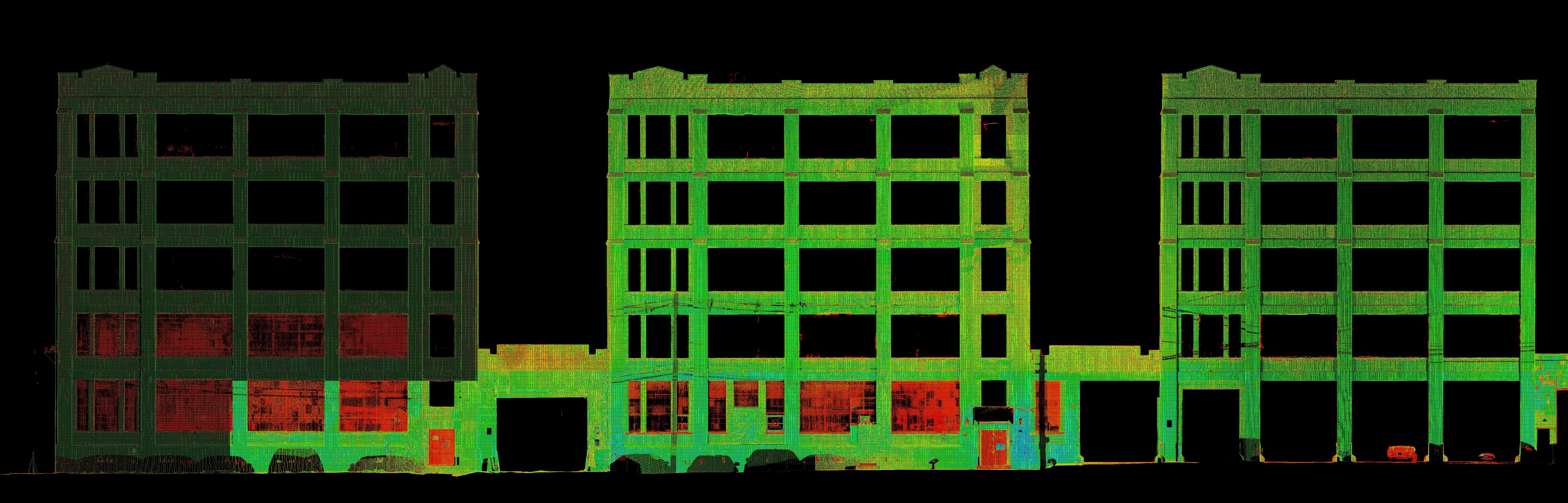
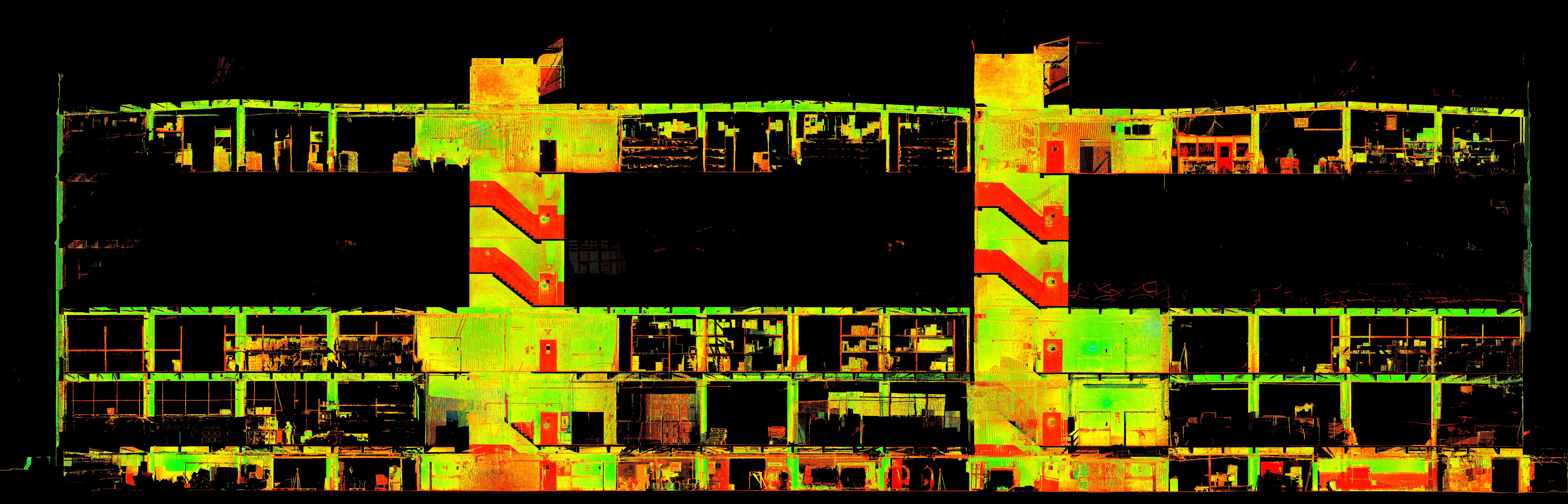
Another area we’re seeing rapid growth and innovation is in scanning/3D measurement, particularly the use of point cloud data. For instance, as shown in Figure 4, we conducted a “vertical slice” through a five-story building. A point cloud was prepared with Leica Cyclone and then published to Dresdner Robin’s internal Leica JetStream point cloud server. The data was then rendered/manipulated/sliced in Autodesk Civil3D using a Leica Cloudworks plugin. This allowed for feature extraction and deliverable development.
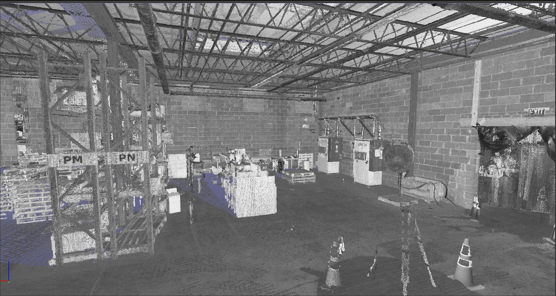
Some of our recent work has also included scans of electrical towers/switch rack equipment and wires, as well as industrial building interiors (Figure 5). These scans can be achieved in total darkness without having to illuminate the subject for data capture. This is something that a photo-based measurement process cannot do. (Note: Recent scans were created with a Leica RTC3560 or P40 scanner. The point cloud data was processed with Leica Cyclone software.)


We expect to see rapid growth, as well as increased technical precision, in this area – thanks in part to the aforementioned tools.
The future is digital, that’s a given. Soon, “institutional memory” will be completely digital, so we will have to use data retrieval methods to manage projects – from storing investigatory data to sweeping site designs.
AEC technology will also play a big part in “workforce mobility,” as recent global events have injected more “flexibility” into various processes – including design teams working from home stations. Our technology will have to be dependable, adaptable, and efficient – accommodating for hybrid work setups or even mobile teams that are entering data from various locations in the field.
AEC technology will allow us to allocate time, capitalize on our resource assets, and keep teams on task when it comes to deliverable production.
The software will allow senior leaders to mentor junior staff, plus it will foster collaboration and real-time communication. We will also be able to more effectively mitigate risk both internally (through streamlined operations) and externally, for our many clients as we navigate the development process.
At Dresdner Robin, we foresee cloud-based team integration, via AEC technology. These applications will allow us to expand our digital work platforms, integrate the best services, and work from a collaborative platform through a project’s entire life cycle. Again, the future is digital, and Dresdner Robin will be at the leading edge.
While AEC technology integration will bring numerous efficiencies to our workflow, it also poses a few challenges. For example, we’ll want to stay atop the latest trends, to ensure our technology remains the most efficient – and adjust our methodologies to take the best advantage that digital systems offer, both for our purposes and to reduce overhead for our clients.
Training and staff adaptability also remain a challenge, as it will be incumbent upon the firm to train its staff accordingly and ensure that the entire team is able to adapt to fast-moving technological trends. There will always be a learning curve, but through established best practices, we will remain at the forefront.
This is a great – and thought-provoking – topic. Here at Dresdner Robin, we foresee wider adoption of “non-contact measurement” services, and teams will most definitely transition to full digital integration. Processes will be streamlined and communicated exclusively via software/digital applications. In fact, the split-screen collaboration platforms will ultimately be the most effective line of communication for busy team members. What’s more, many of these internal methods will be scalable for public agencies and municipalities. COVID-19 has ushered in an era of cloud-based public meetings. We expect these digital meetings to outlive the virus shutdowns. Teams will need to prepare themselves for effective digital presentations – this will be to various land-use boards.
Our wish list would include easier cross-channel data integration (via open-system architectures), more effective price points and scalability, as well as improvement in upward migration of field data through design to deliverables.
But the space is moving rapidly; so even while it poses new challenges, Dresdner Robin will remain a leader – both for the way it manages its projects on digital platforms, and ways it uses new tools to survey, measure and design complicated urban sites.
Acknowledgments: The responses to the questions for this profile were provided by Fred Worstell, President of Dresdner Robin. The profile itself was facilitated by Dan Gunderman of Violet PR.
Have comments or feedback on this article? Visit its AECbytes blog posting to share them with other readers or see what others have to say.
AECbytes content should not be reproduced on any other website, blog, print publication, or newsletter without permission.