


Now that BIM has been firmly established as the go-to technology for the design and construction of buildings, the expansion of the “information modeling” concept to infrastructure as well as cities is also underway. The beginnings of both these initiatives were captured in these two AECbytes articles respectively: Extending BIM to Infrastructure published in June 2014; and City Information Modeling, published just last September. While infrastructure modeling seems to be a natural offshoot of BIM and closely related to existing building modeling technologies, city information modeling or CIM is a different beast altogether, which is why most of the upcoming CIM solutions are being built from the ground up by completely different developers than AEC technology leaders like Autodesk and Bentley. One such developer is Cityzenith, whose 5D Smart World platform for CIM is rapidly gaining traction. This review takes an in-depth look at Smart World and how it works.
While Cityzenith’s 5D Smart World platform was officially launched only a month ago, it has actually been in development for several years, going hand in hand with the growing “smart cities” movement worldwide to make better planned, more connected, and more livable cities. In fact, CityZenith’s product was, until recently, called “Smart City” rather than “Smart World.” It turns out that the new name is a more accurate description of the platform because, as I pointed out in my City Information Modeling article, CIM is primarily a technology initiative while smart cities involve a lot more processes such as policy, politics, governance, etc. While CIM can greatly help in enabling cities to be smarter, CIM by itself does not guarantee a smarter city, just as BIM by itself does not guarantee a smarter building. BIM however can provide a solid backbone for the creation of a smarter building, and CIM can do the same for the creation of a “smart city.”
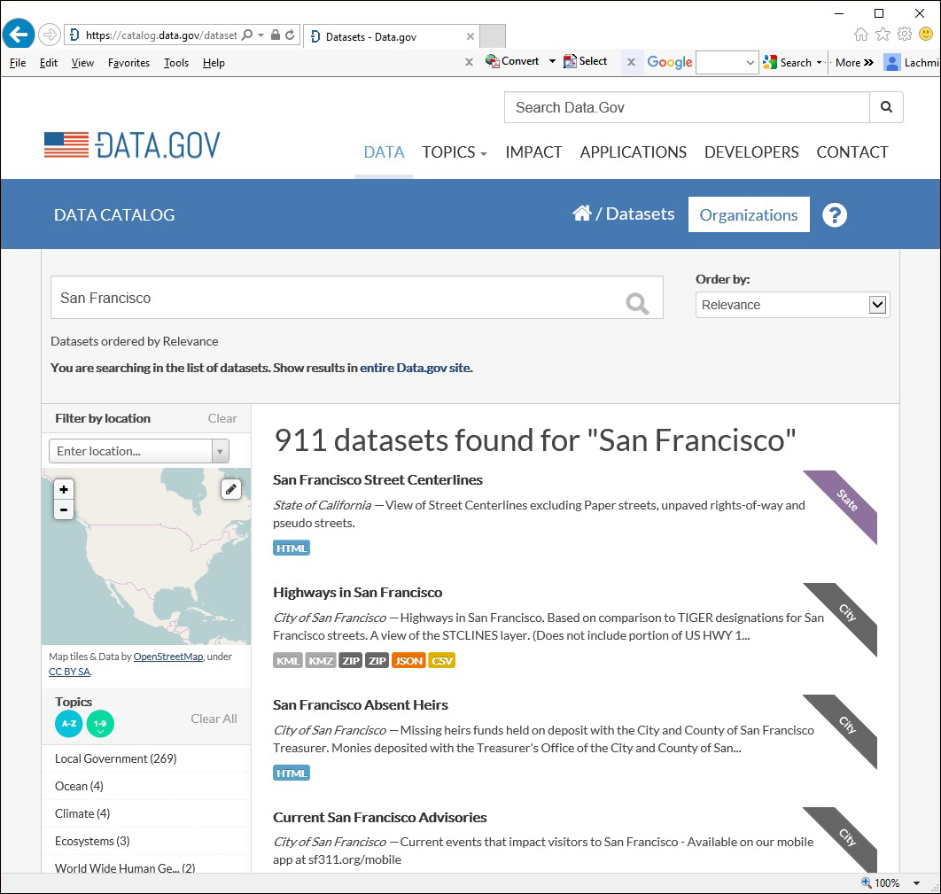
The objective of Smart World is to aggregate all the available data for a city, normalize it across its platform, and make it accessible through a web browser. The data that is aggregated includes all the public data that is published for the city as well as any data that is created by private enterprises. With regard to public data, I was surprised to discover, in the course of background research for this review, that there is actually a lot of open data in myriad categories that cities publish and update periodically—see, for example, the data.gov website shown in Figure 1, where a search for San Francisco pulled up 911 datasets in categories such as roads, arterial streets, truck routes, green roofs, flood zones, seismic hazard zones, parking locations, street cleaning schedules, and so on. Of course, not all of this data is needed for CIM, but for those datasets that are required, they can be exported in a format like JSON (shown next to the corresponding dataset in Figure 1), and then imported into Smart World.
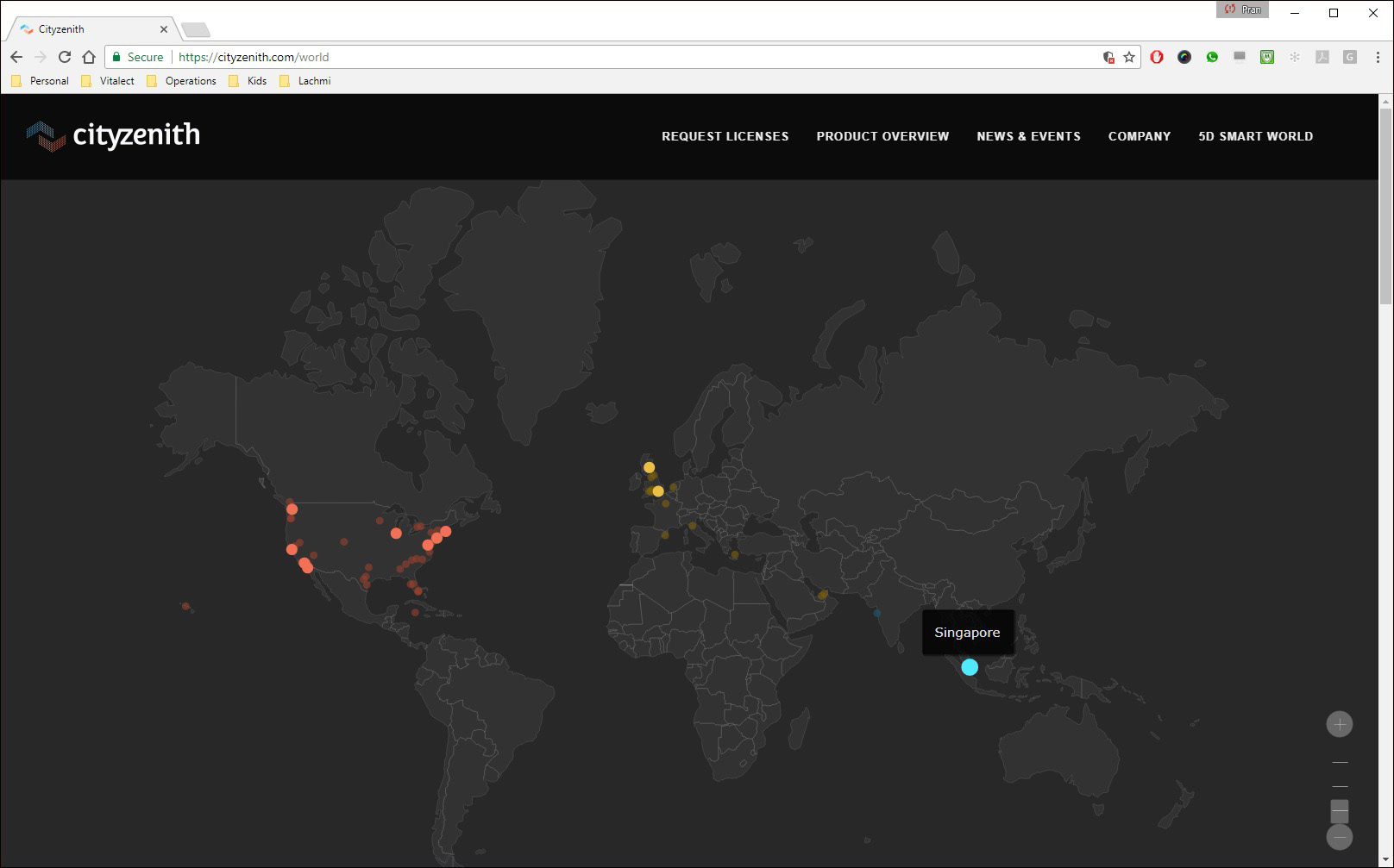
Of course, all datasets are city-specific, and importing a dataset into Smart World only makes sense if that city has been modeled in Smart World. At the moment, Cityzenith has the models of about 10 cities fully built out, with several more in development for release soon. As shown in Figure 2, the cities in Smart World that are currently available are located across the globe, including Chicago, San Francisco, New York, London, and Chicago. Those in the pipeline include Mumbai, Amsterdam, Barcelona, Denver, etc., as indicated by the fainter dots on the Smart World map in Figure 2. Creating a CIM model of a city in Smart World is not simply a matter of pulling in the publicly available datasets for that city, it also includes detailed building models that are usually developed by private companies and available for sale, much like any other commodity. Cityzenith also has its own team of modelers and developers who create city models in-house, along with other needed data that is not publicly available.
With regard to the decision about which cities to cover, any Tier 1 city—such as Sydney, which is currently under development—is a no-brainer, as there is likely to be a lot of demand for it as well as a large number of datasets available to bring into Smart World. In addition, there are likely to be several vendors selling detailed city models for it. Cityzenith will also take on additional cities in response to customer requests, for which it will likely have to put in more work to create a usable CIM model because the base data may not be readily available. Of course, over time, it would like to cover as many cities as possible, both large and small, all over the world. With regard to its potential user base, the immediate demand comes from AEC firms, who would like to get a detailed understanding of the large context of their planned building and infrastructure projects. Additionally, a CIM model of a city would be very useful to government agencies such as city planners, regulatory agencies, city administration, public safety and security, etc. (Figure 3), as well as private industries such as real estate, insurance, telecom, and so on.
Smart World is a cloud application, so it runs entirely within a browser, connecting to city data stored on Cityzenith servers in real-time and streaming it across the Internet. Once you have an account, you can click on any of the available city models on the main page of Smart World (which was shown in Figure 2) and it opens up in the browser. As shown in Figure 4, the entire model is not loaded right away, but as you zoom or pan, the parts of the model that are in focus are shown in more detail. While the technology is cloud-based and enabled through the Internet, the specifications of the computer on which Smart World is accessed make a big difference to its performance—the higher the graphics capability and processing speed, the faster and better the streaming experience will be.

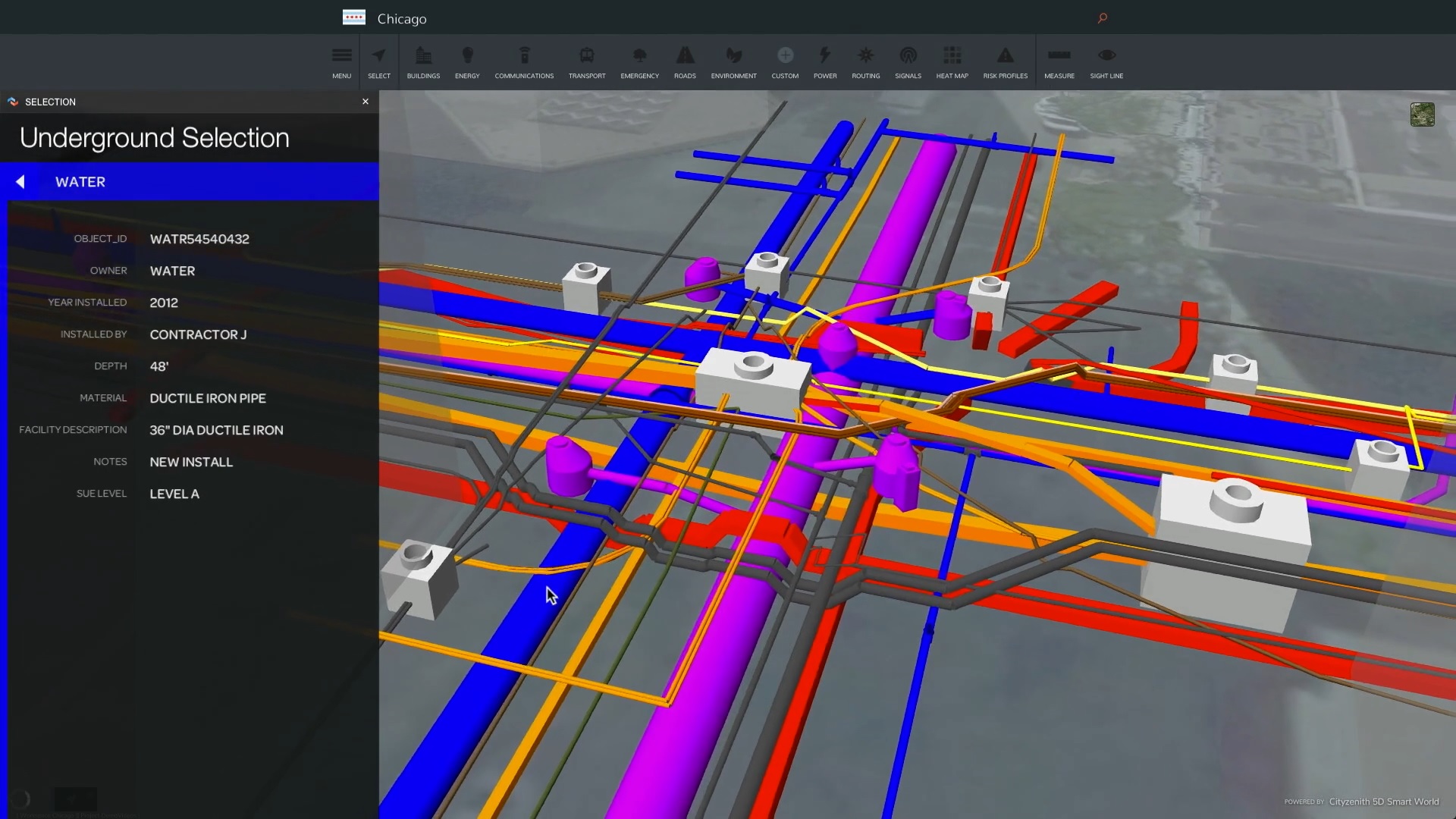
In addition to basic navigation tools and the option to change the basemap imagery for the city model from among 14 display options—the one used in Figure 4 is “Satellite”—there are tools to see the model in 2D or 3D; show or hide overhead buildings, underground structures, and roads; and selection, annotation, and measurement tools. Selecting any element in the model displays more detailed information about it. While most of these features are standard in any kind of CAD or BIM application, there are a large number of capabilities that are specific to CIM. For example, while the concept of layers is familiar to AEC professionals, layers in Smart World are used to hold all the different kinds of data from different sources that have been aggregated and curated by Cityzenith for that city. You can see all the available datasets sorted into different categories, and you can select any of these datasets to see more information about it such as its source, when it was last updated, and a preview of it (see Figure 5).
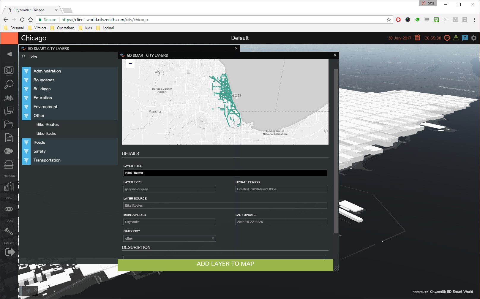
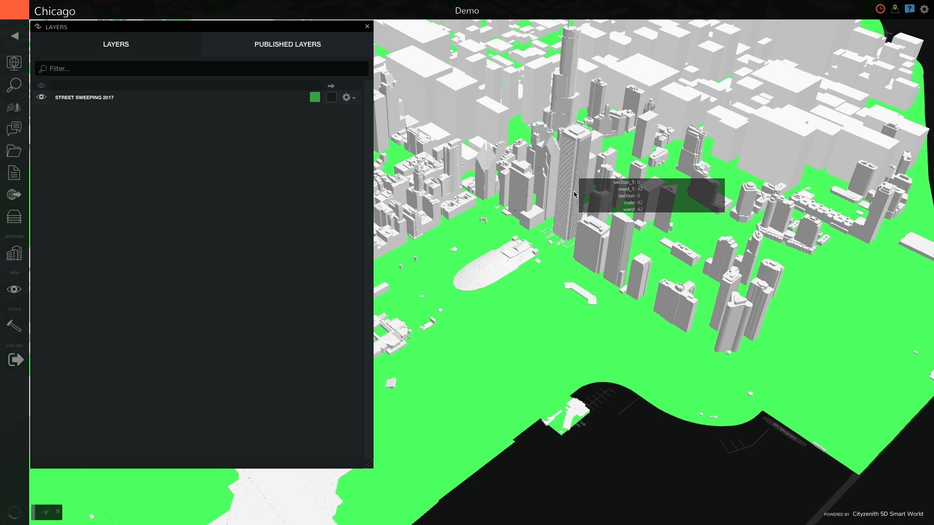
If it is of interest, you can chose to add this dataset as a layer in the model. All you now need to do to view this data is turn on the visibility of the layer from the Layers palette (Figure 6). For a typical city, there would be close to a 100 datasets available in different categories that Cityzenith has brought in and which it regularly updates to ensure that users are getting access to the most current data. Another example of a published dataset for Chicago that is available in Smart World and which has been added as a layer with its visibility turned on is shown in Figure 7.


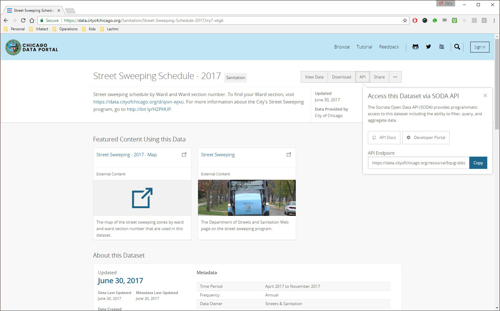
Other datasets that may be required by individual users can be imported into Smart World and normalized so that they can be used just like any other dataset that is already in the system. These datasets can be in the form of static files in common formats such as DWG, XML, KML, JSON, etc. (as shown earlier in Figure 1), or they can be dynamic links to datasets in the form of APIs, as shown in Figure 8. This link can then be used in Smart World to create a new dataset that can be activated to see the data (Figure 9).
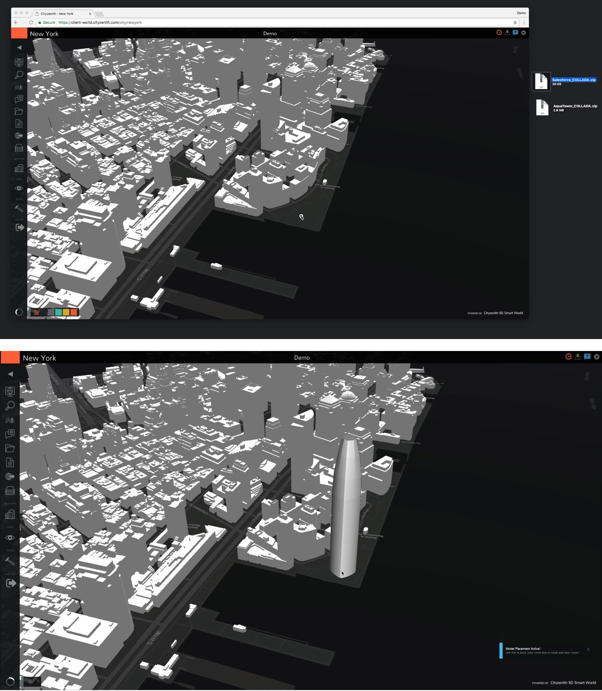
Additional features in Smart World include the ability to create projects and collaborate with a team on a project; drag and drop 3D models of buildings in a number of formats including COLLADA, FBX, OBJ, and SketchUp into the city model (Figure 10); and run queries on the data in the city model for answers to factual questions about the project, such as the location of all street lights in a specific area, the location of a parking garage closest to a particular street intersection, and so on.
The ability of a platform like Smart World to bring together the large amount of data related to a single city, spread out over hundreds of datasets published by the city as well as data provided by private organizations, normalize it so that it can be seen in relation to each other, and enable it to be accessed in real-time through a web browser seems to be almost “magical.” The immediate usefulness of this capability to any public or private enterprise that deals with any kind of work situated in a city—and it’s hard to imagine anything that isn’t—is a no-brainer. And given that this would be true for cities all over the world, Smart World could just keep going, developing CIM models for more cities and continuing to update them with newer information. Our cities are constantly in a state of flux, so any model that attempts to capture a city will need to be a dynamic one—it is never “done.”
While the overall usefulness of the application is unquestionable, I did find some issues in the course of working with it that I hope will be improved going forward. The user interface was somewhat clunky and not very intuitive or responsive. The navigation tools, in particular, were difficult to use, and I really missed the availability of a Home button to quickly reset the view if I accidentally “lost my way” and navigated to an unknown area of the model. Also, I don’t currently have a top-of-the-line computer with the latest and greatest specifications, as a result of which there definitely were performance issues with running the application. Given the fact that Smart World is a cloud-based application that runs on a browser, it would be helpful to the average user to be able to run it on a standard computer without a degradation in performance, rather than be forced to upgrade to the high-end workstations that are used by designers and gamers.
While these are relatively minor issues, the biggest limitation with Smart World at the moment is its near-complete lack of analysis capabilities. The whole point of CIM is to be able to create intelligent city models that can be used for a wide variety of planning, analysis, and evaluation tasks to make our cities smarter and more livable. Examples include planning and zoning, analyzing traffic patterns, determining the impact of a proposed development on a neighborhood, predicting the areas that would be impacted in the event of a disaster such as an earthquake or hurricane and make the necessary plans to mitigate it or determine how emergency and evacuation services would be provided (see the article, “Hurricanes and their Aftermath: How Can Technology Help?”).
In fact, the scale of data and analytics for city models is exponentially larger compared to building models, and while Smart World has some APIs that third-party developers could potentially use for creating analysis tools, it does not have, as far as I could tell, any kind of mathematical models underlying the different components of its city model. In that respect, it seems more analogous to a generic 3D modeling tool for a building than a BIM tool which should (ideally) capture the relationships between different building components. Smart World shows a lot of data, pulled into different layers from different datasets, but it is not, behind the scenes, building up any meaningful relationships between the different sets of data, without which none of the sophisticated analyses mentioned earlier can be carried out.
However, this does not detract from the fact that Smart World is extremely useful even in its current form, and it’s a terrific start to the concept of CIM (city information modeling) that we really haven’t seen much of yet. What is most fascinating about CIM is that it is not only relevant to those in the AEC industry, but to everyone. Buildings mostly impact those who inhabit them, but cities impact everyone who lives in them. The importance of the technology simply cannot be overstated.
Lachmi Khemlani is founder and editor of AECbytes. She has a Ph.D. in Architecture from UC Berkeley, specializing in intelligent building modeling, and consults and writes on AEC technology.
Have comments or feedback on this article? Visit its AECbytes blog posting to share them with other readers or see what others have to say.
AECbytes content should not be reproduced on any other website, blog, print publication, or newsletter without permission.